x e2 pantip: นี่คือโพสต์ที่เกี่ยวข้องกับหัวข้อนี้
Tuesday, August 16, 2016 1:28 PM
Iceland is my dream trip ever since I was a college student. The Pixpros members were travelling there in 2012. The photos taken from Iceland were just amazing and it’s the first time I knew this amazing country existed. I still remember the determination I had from that day that I must also visit Iceland.
The main problem of travelling to this country, apart from the extreme weather like that of the wind and snow, the extreme of taking leaves and money is another important factor. So this plan has kept there ever since. After working for sometimes, I ask for a long holiday leaves in order to make my 4 years-dream-trip comes true.
Due to the Songkran festival is limited, so I have to take leaves on Chakri day too. Finally, I got 13 days leave in which 9 days will be spent in Iceland, half a day in Oslo and another day in Moscow, including a day and a half of flying. I travel with Russia’s Aeroflot airline from Bangkok to Oslo of Norway. After that, I fly to Iceland with Iceland Air and coming back the same route.
Day 1 : Bangkok – Oslo, transit at Moscow and spend a night at Oslo
Day 2 : Oslo – Iceland, arrive at Reykjavik in the late evening
Day 3 : Reykjavik – Vik
Day 4 : Vik – Jokulsarlon
Day 5 : Jokulsarlon – Egilsstaðir
Day 6 : Egilsstaðir – Akureyri
Day 7 : Akureyri – Grundarfjörður (Kirkjufell)
Day 8 : Grundarfjörður – Reykjavik
Day 9 : Reykjavik (Golden Circle)
Day 10 : Reykjavik – Keflavík (Stop by at Blue Lagoon)
Day 11 : Iceland – Oslo, travel half a day at Oslo and take a late night flight to Moscow and spend a night near the airport
Day 12 : Roam around Moscow entire day and fly back at 19.00 p.m.
Day 13 : Arrive Bangkok in the morning
The estimate budget of this trip is 75,000 THB per person for 12 days (Iceland-Oslo-Moscow) in which half of it is a flight ticket. My flight ticket is 36,000 THB. I didn’t get a very good price due to too much hesitation of booking the ticket (the best I could find was a promotional ticket of Qatar Air at 26,000 THB). Anyhow, the excellent service from Aeroflot made up that part. The worst of it was the ticket of the Iceland Air was up the day I booked and down about 3,000 THB in the next few days.
The price in this table has been divided by 6 people including the van and the petrol.
The SUV 7 seats equip with GPS for 9 days is 43.152 THB and the petrol is 27,534 THB.
We rent the Dodge Durago, the 4 WD van from Green Motion Company. It is an automatic gear consuming gasoline 95 which consumes gasoline more than usual. You could have saved more money with a smaller car.
Very important note!!!! Daytime and nighttime in Iceland is varied in each month. I visit from 6-18 April 2016 and it’s 14 hours daylight so we get to travel until 19.00 or 20.00 p.m. If you are coming here during the winter where the daylight is less than 10 hours, you can’t travel and share the same plan with me. It’ll be dark before you can go to every place. Also, winter time comes with a rougher road where several route is inaccessible so you must spare sometimes for snow storm or in case the road is closed.
Accessory
FUJIFILM X-E2
XF18-135mmF3.5-5.6 R LM OIS WR
XF10-24mmF4 R OIS
XF55-200mmF3.5-4.8 R LM OIS
XF35mmF1.4 R (Got it along the way)
And iPhone 6s for some photos and videos
Preparation
1. Documents
Iceland is included in a Schengen Visa. The visa can be applied through Denmark Embassy at Phloen Chit. It’s fairly easy to apply as there are many reviews available. In addition to visa and passport, Iceland doesn’t require further document. When we enter Schengen country, we might be asked what we are doing there. It’d be much more convenient if we have a concrete plan or the hotel reservation when being asked. As for Russia, you probably want to have a paper confirming Thailand doesn’t need a visa to enter this country as I heard some immigration officers are not aware of it. Anyhow, from my 2 times experiences, I didn’t have to show any further proof.
http://www.thaiembassymoscow.com/download/pdf/th-ru_visaexempt_ru.pdf
If you want more information about Russia, I used to write a review about it here:
http://pantip.com/topic/33621110
2. Clothes
Iceland is considered warmer than the neighboring countries. It has the warm tides running by so the cold is not the main obstacle. What is extreme here is the “wind”. The wind in this country can easily blow the doors into half and it thus also goes through our sweater. If you are visiting during the winter (October-April), the weather goes to a single number negative degree. For the clothing, in addition to our normal clothes, we need to add three more layers: base layer, mid layer, and shell layer.
– Base Layer is the most inside layer or Long John. This layer is to keep the warmth with us. The easiest way is to wear heat tech of Uniqlo or you can find it form Platinum Mall. This layer keeps us warm about 1-2 degree.
– Mid Layer is sweater layer. We can wear many sweaters depending on the weather like fleece jackets, or down jackets of duck/goose feather. If the weather gets to a negative degree, down jackets is recommended as it’s the warmest. In case you are not used to with the cold, you can also wear the fleece jacket before putting on the down jackets.
– Shell Layer is not necessary for downtown sightseeing, only the base and mid layer is sufficient. However, Iceland is a natural sightseeing place with strong wind and a high chance of rain and snow, so shell layer is recommended. The main use of it is to protect us from the wind and in turn it also protects us from the rain. The good windproof jacket allows us to walk in the rain for hours without the inside of us being wet which I have tried in this trip. The best brand for this kind of clothes, jacket, pants or shoes is Gore Tex. You can be sure to get protected from the wind and rain when using this brand. Even the North Face, Timberland, they also use Gore Tex to make their jackets and shoes.
– Pants. Generally, our legs can endure more cold than our body. If the weather is not in negative degree, only jeans and Long John is sufficient. Anyhow, this also varies from person to person. Probably, the windproof pant is a good solution in case that day has strong wind or rain.
– Gloves, socks and shoes are very important as hands and feet are the most torturing parts from the cold. We should try to find the windproof or a leather glove that is not so big, otherwise, it’s inconvenient for us to move around and we might have to take them off at the end. We must endure a bit for the hand as the right size of the gloves can’t give us much warmth. But if it’s too cold, you can also put your hands into your jacket. What we must take care the most is the feet as we can’t put them inside our jacket. It’s recommend to find wool socks as they are warm and not absorbing water. We can wear it with waterproof boot. The general leather boot is alright but if you can get the Gore Tex, it’d be excellent. It can prevent the wind, the cold and snow and its rubber base help us not to get slipper while walking on the ice.
– Hats and scarfs. Hats are necessary if our sweater doesn’t have hood. The main purpose is to cover our ears as it gets hurt when we stay in the cold weather long. Or, the ears cover works too. Actually, I use scarf to cover my mouth and cheek more, otherwise, it could be blown away. The neck is already quite warm when we wear double jackets.
Here are small tips about down jackets:
We have to look carefully for the genuine duck/goose feather as most brands use the synthetic fur which is not as warm. The lifetime is also less, only about 2-3 years whereas the genuine feather can stay for about 10 years. The genuine feather can also be folded into small pieces.
Meanwhile, down jacket has different level of warmth which is called Fill power/Fill down from 500-1000. The trekking brands like The North Face, Columbia, Patagonia will mark Fill Power in each jacket whereas some brand doesn’t have it marked like Uniplo. Somehow, this give us some inconvenience when use it because we don’t know how cold it can help.
Fill Power 500-600 is warm enough in a single layer for the weather not less than 10 degree like the Ultra Light Down Jacket of Uniqlo.
Fill Power 600-700 is warm enough from the single digit to 0 degree and most of The North Face jacket start at this level.
Fill Power 800 and up is warm enough for negative weather. I myself use the Fill 800 of Merrell for this trip.
Many people don’t like the down jacket as it’s fluffy and made us look like preserved pork in bundles, and this is nothing we can do, haha. But the good quality down jacket wouldn’t be as big. The bigger the shirt doesn’t always means the warmer. Sometimes, the big down jacket puts too much of the quill which doesn’t make it any warmer but just bigger. The good down jacket filled more with the feather. It’s less swelling and can be fold into smaller piece. You can also look at the tag of %feather; it’s very good to have 90-100%.
3.Food
The biggest problem for Iceland is food. Apart from there’s almost no restaurant out of town, the restaurant here is very expensive. A cheeseburger and a coke is 400-600 THB and we certainly cannot afford it for 12 days. The solution is bringing some ready-to-eat food from Thailand. Mainly, it’s rice canned, fish canned and Roza Prompt where you can eat after soaking in the warm water as well as instant noodle for a quick meal. Also, we can buy bread, ham, salami from the market here which is cheaper than eating in the restaurant. Once in a while then we also go to restaurant.
**Important note: The microwave is not widely available, so we must bring instant food that can be heated with warm water.
4. Money
The currency of Iceland is ISK. The exchange rate when I go is 0.3. Most of places only accept ISK except the big restaurant that they would also take the Euro so we must prepare enough ISK money. We can exchange it at the airport or from Schengen countries (Thailand doesn’t have ISK, we must exchange for Euro first). Anyhow, the credit card is acceptable in almost every place.
But we must be cautious at the gas station. Most of the gas station here is a self-service where we can use the credit card but we must know the 4 digit pin which many people might not know. We must apply for these 4 digit pins with the issuing bank. Another paying method is by pre-paid card which can be bought at the mini-mart of the gas station or at the market. It is the cash card that we can fill the petrol and food in the mini-mart. The gas station here has two colors, green and red. If you buy any color card, you can only use at the same color gas station. Since at certain route, very few gas station and mini-mart is there so it’s recommend to buy some in advance and fill up the petrol when chances allow. Even the GPS can give us the location of the gas station, we can’t be certain of which one is still open.
5. Driving
The main road of Iceland is no.1 road. This road is running around the island and some people call it Ring Road. It’s easy to drive and almost the entire road is paved. Most of the road is straight, not so curving but it’s quite narrow and the side of the road is deep which gets us a bit nervous when passing or overtaking the other car.
**Important note: The Ring Road at the east is relatively in bad condition. If you want to go around the island, it’s recommended to drive on the road no. 96 and 92 instead when you are in the east in order to go to Egilsstaðir. These routes are in good condition and no need to go up the mountains as the tunnel has been drilled along these routes.
Here, the steering wheel is on the left and we cannot go over 90km/h. Many road cameras are there. We must be careful when opening the door as it could be broken if we open it against the wind direction. It’s recommended to drive in the middle of the lane and when the other car comes then we can drive to the right as the road is narrow and the side is deep.
The road condition is subject to the weather in Iceland, we can check whether the road is accessible via:
http://www.road.is/travel-info/road-conditions-and…. In order to not waste our time, it’s recommended to check it prior to every trip.
6. Aurora Tracing Mission
There are three factors affecting the chance of the Aurora to show up: activity (KP), location and weather.
1. Activity or KP- the harder the explosion, the more likely the Aurora to come. It’s measurable from 1-9 KP. The more the KP, the more intense the Aurora could get but it also depends on the location.
2. Location – Of course, the closer to the globe’s axis, the higher chance to see it. Below photo shows the locations where Aurora can be seen.
Iceland is in the KP3 which means that we can see the Aurora with our eyes at this scale. If we are at the KP 4-9, we can clearly see the Aurora all over the sky. And if we want to see the Aurora at Germany, we must wait on the day the KP 8 is there and we can see it vaguely.
3. Weather – This is the main factor causing us unable to see the Aurora. Since we are very near to the globe’s axis and Aurora Activity is usually occurred almost every night, the only factor preventing us from seeing the Aurora is when the sky is closed. I experience myself on the day the KP is 5 and in theory, the Aurora would have been very beautiful dancing except the clouds are all over the sky and it’s completely dark, I’m so upset.
We can check the weather forecast of Iceland from
http://en.vedur.is/weather/forecasts/aurora/. This website tells us the value of KP and the density of the clouds at each location of the island.
From the above photo, the greener the area is, the more the clouds are. The last thing we want is to see the dense green of where we are at with the high KP. We can also check an hourly forecast from below tab. From this photo, it is the Aurora Activity KP 4 but the sky is almost closed in the entire island. There are some clouds on the left side but if we want to have a clear glimpse of it, we must boat to the middle of the sea where it’s white.
This map is very beneficial for Aurora hunter. If the KP happens to be high but it is cloudy then we can drive to the place where the clouds are less to increase our chance. I met a guy who drives 2 hours back and forth in order to have a clear sight of Aurora. To trace the Aurora depends on little luck but more on advanced planning and efforts.
▲ Iceland 01 ▲
Our first day is spent on the road. Our route goes pass 3 countries and 3 different time zones. The Aeroflot ticket said BKK – Oslo (Norway) departs at 10.00 a.m. and arrives at 19.00 p.m. It looks like we only fly for 9 hours but in fact, it is 14 hours flight since the Oslo time is 5 hours behind us.
Our first destination is Moscow (4 hours behind). The ticket said 10.00 – 15.00 but the actually time spent is 9 hours and 50 minutes. We fly with the Boeing 730 which offers spacious seat and personal TV screen (the new movie like Star war: Force Awaken is available). The kids’ game like the Puzzle is also there. The USB charger for our phone is there as well. Two meals of breakfast and lunch are served (for Moscow). It is the European style bread and cheese, salad and the main dish of either chicken or fish. Since there are not many things to do, I look at the map to learn that we are flying over Myanmar, Bangladesh, Bhutan, India, Uzbekistan, and going in Russia.
At Moscow, our flight gets delayed for 30 minutes and the flight to Oslo has also been delayed. When transiting here, we must scan our carry-on bag again. It takes quite sometimes as there’re only two scanning machines but we must take off our shoes and belts. Before boarding the flight, the staff comes and carefully check our Schengen visa again (they look at every page of passport and look at Schengen visa page for a long time and touch it as well). We have about 2 hours and 30 minutes for transit. After we go through every procedure, we have time to walk around a bit.
Now, we fly with a smaller aircraft to Oslo. TV screen and USB charger are no longer available. Sandwiches are served. Now we go to another time zone of Olso (1 hour behind Moscow). The actual flight is 3 hours. The weather is nice so we get to see the high angle view of Norway before landed.
We reach Oslo Airport (Oslo Lufthavn) at about 20.00 p.m. It takes less than an hour to go through immigration and collect our luggage. When we are going in groups, only the first few people that the immigration asked many questions and they let us pass quickly afterwards. This airport is in Gardermoen. It is a small airport with wooden and cement theme. The light wooden color reminds me of huge wooden ship. From all the airports I’ve been to, here is my favorite in term of theme and atmosphere, possibly also due to people are not crowded when we reach here.
We spend a night here at Oslo and fly to Iceland tomorrow noon. The bus sign is there at the luggage belts. The monitor screen clearly tells us the bus route, the platform and timetables. Nearby is the exchange counter where we can exchange Euro for NOK (Norway currency) and ISK (Iceland currency) with a fee of 50 NOK per time. If you want to deposit your luggage, you need to follow the Lost & Found sign to the counter. The fee is 87 NOK for 5 hours.
We book our hotel at Gargermoen Hotel Bed & Breakfast from booking.com. We chose here because we can take the direct bus (885/815) to the airport. The bus fare is 50 NOK and only a stop away from the airport. We can clearly see our hotel from the bus stop. It is a yellow cute building. We book the room with a share bathroom for 300 NOK/person/night. Since there’s few guests tonight, the owner upgrade our room to private bathroom (without any notice in advance).
▲ Iceland 02 ▲
The breakfast is free here. It is a European buffet like bread, cheese, ham, salami and many sandwiches. Nearby our hotel is a small village and a vast field, such a nice atmosphere. I get to walk around a bit. It is a single digit degree weather and it’s just chill.
The security is strict flying from Oslo to Iceland. I must repeat that we must take out the notebook, iPad and camera out of the carry on; otherwise we’d be called for individual search which consumes much time. The random check for gun powder is there from time to time as well.
This time we are flying with Iceland Air. It is also the Boeing 777 but with personal TV screen and USB charger as well as fun clip for traveling in Iceland. There’s no food or earphone for economic class but iPhone’s earphone can be used. We are going to another time zone again (1 hour behind Oslo). So it actually takes 3 hours for 14.45-16.45 flight. You can see the endless view of southern Iceland like the Jökulsárlón Lake and Hallgrímskirkja Church if sitting on the right wing.
This airport is called Keflavik, the same name with the city. It is a small airport with restaurants and supermarket. It takes less than 30 minutes from the aircraft landed to collect the luggage and go out of the airport. We don’t have to go through immigration again. We can simply collect our luggage and out as now we are in Schengen countries already.
It took us by surprise when coming out and get a welcome by the strong wind. It’s like someone is pushing us. We shouldn’t carry anything that is light; otherwise it can be blown into the sea in no time. It would be best to have a double set of the handkerchief or the cloth for wiping lens in case it goes to the sea sooner than we expected.
We rent the van with Green Motion. The staff pick us up from the airport in order for us to get the van from downtown Keflavik which is only 15 minutes’ drive. Like I mentioned earlier, our van is Dodge Durango which consumes lots of petrol.
After that, we go to Reyjavik which takes about 40 minutes’ drive from Keflavik. Soon, we find the gas station and a market. The Bonus and Kronan are two markets here. If you are taking the afternoon flight, I recommend you to buy some food now as the shops here close early. Almost every shop closes at 18.00 p.m. and the 24 hours open shops are very expensive.
Reykjavik is the capital city of Iceland. It is said to be the northern capital city of the world with 2/3 of the country population. In fact, only about 300,000 people are living in Iceland which means only 3 people are living in each kilometer square when calculating by the entire island.
Here is the prosperous center of Iceland. The second largest city at the north called Akureyri but nothing can be compared to Reykjavik like shops and restaurants. This city has lots of tourist attractions like the giant organ designed Hallgrímskirkja Church or Solfar Sculpture near the sea. The bar is also filled with people on the weekends’ nights.
Hallgrímskirkja
We stay at Igdlo Guesthouse tonight. It’s like apartment looking from outside. It is a 3 story house with 2 public bathrooms in each floor. The refrigerator and public kitchen is there for cooking. You can also buy a breakfast (7 Euro) which consists of bread, ham, salami, milk and cornflakes.
Most of the guesthouses are self-service, including here. Before checking in, the host emailed us the password to the house. Once we enter the house, the note is there to give us our room. We can pay cash or by credit card when we meet the host or if we didn’t meet with the host, the rent will be deducted from the credit card we provided on the website. The room here is 22 Euro/person/night (about 900 THB) and the best thing is it’s only 700 meter away from Hallgrímskirkja Church.
Most of the guesthouses are self-service, including here. Before checking in, the host will email us the password to the house. Once we enter the house, there’ll be the note telling our room. We can pay cash or by credit card when we meet the host or if we didn’t meet with the host, the rent will be cut off from the credit card we provided on the website. The room here is 22 Euro/person/night (about 900 THB) and the best thing is it’s only 700 meter away from Hallgrímskirkja Church.
The first night emphasizes the notion of the gloves are mandatory when taking photos at the cold and windy places. Although it’s quite inconvenient wearing gloves, our hands get stiff after facing the cold too long and eventually we could drop camera or lens. If we have patience wearing it for a day or two, we will get used to it pretty fast. And before we know it we could chat with the gloves on as well.
▲ Iceland 03 ▲
0. Hallgrímskirkja (Morning)
1. Seljalandsfoss
2. Skogafoss
3. Sólheimajökull Glacier
4. Dyrhólaey (Got cancelled due to heavy rain)
5. Black Sand Beach
6. Vik
0. Hallgrímskirkja
After two days on the road, finally it’s time to actually start the journey. We start by visiting Hallgrímskirkja Church, the biggest church in Iceland and one of the rare expressionism buildings.
Our first plan is to take the sunrise shots at this church as the lighting comes in good direction. Now the winter is over and the summer is here so daylight is longer. The sun rises early and sets late. While we are here, the sun rises at 06.30 a.m. and sets at 20.30 p.m. But the sun is not going up or down in a straight line but oblique. So the first light shines before 05.00 a.m. and before it’s completely dark is already 22.00 p.m.
But the sky is closed. It’s completely closed as if to tell us to sleep more but we go anyway, haha. Both wind and rain hit on us. The wind is much stronger than the first day (yet the strongest one in the trip). That the church is located on the hill, it’s windier than other area. The wind is so strong that I can’t set the tripod stand but must grab to it the entire time. Repeat again, without the windproof jacket, you will get a cramp.
After taking photos for a while, we can’t fight with the cold any longer. We go back to have breakfast at the guesthouse. Today we plan to travel along the southern coast of Iceland and stay at Vik.
1. Seljalandsfoss
After leaving Reykjavik, our first stop is Seljalandsfoss. It’s quite difficult to pronounce, isn’t it? Seljalandsfoss waterfall has the character that we can walk below it which is a cave. If we come on the nice weather day, the photo taken would be very beautiful. The rainbow appears every time the sun shines at the waterfall in this country.
But the sky is closed the day we visited. The rain is there as well as the wind. The camera gets wet as if it’s waterproof. The cloth is always at my hands to wipe out the water from the lens. It’s such an extreme case that could have ruin the camera (luckily that’s not the case, thanks to Fuji XE2).
2. Skogafoss
The next stop is Skogafoss, one of the XL size waterfalls of this country. On the sunshine day, we can see the double rainbows on the water, certainly, the day we visited is not the case, haha.
Originally, this cliff is a shore. When the water largely decreases back to the sea, the water of Skoga River that used to run into the sea pours below and thus becomes a giant waterfall. The legend has it that the first Viking who sailed to this island left treasure cases in the cave behind the waterfall. The local people indeed found that case but it’s only the ring that they could take out before that treasure case drowns into the water. Nowadays, that ring is showed at the museum of Iceland.
Actually, the tourists can also walk up onto the waterfall and seagulls’ nest is there. However, the weather is quite bad that day so we didn’t go up.
3. Sólheimajökull Glacier
Sólheimajökull Glacier is a small glacier located not far from Skogafoss and the main road. The glacier walk tour is also available but we must contact the tour in advance. We can also just park at the front and walk in about half an hour. The view is quite beautiful. The coffee shops are also there at the parking, allowing us to have some warmth (in the winter, the glacier is almost near the parking but it’s melted some when we visited).
Here is the coldest stop for today. Party, due to the rain starts to pour heavily when we start walking but we are fine since we wear the waterproof and windproof outfit. I also left my Fuji XE2 in the van and take the Xiaomi Yi with water case out, so all the photos come from this camera.
On the way back, that rain turns into freezing rain which increase the cold to another level. We go straight to the coffee shop on the way out. Enjoying a cup of latte in this warm weather under the heater is simply a happy time even though it’s more expensive than the Starbucks’s latte.
4. Dyrhólaey
We decided not to visit here because the rain is heavy and Dyrhólaey is a windy cliff so it looks too dangerous to visit while the storm is coming. Finally, we go straight to Black Sand Beach.
Dyrhólaey taken from Black Sand Beach
5. Black Sand Beach
Black Sand Beach is a black beach from the volcanoes’ soil and lava rocks that have been eroded by water. It would have been an interesting beach and we could have enjoyed watching different shapes of the rocks the whole day had we come on the nice weather day. But today, more than 2 meter height waves hit the shore and the wind is constantly and strongly hitting us. The wind is so strong that we feel like the rain is like the sand when pouring on us. The strongest wind makes us to firmly stand in order not to fall. When walking against the wind, it’s like we are trekking, each step is so heavy and difficult.
Here is our last destination for today. The rain doesn’t stop after the glacier so we go straight back to our hostel. Another stop that we skipped in addition to Dyrhólaey is Plane Crash Site where the photographers like to take photos. Later I asked the staff at our guesthouse to learn that the land lord has closed the road so we have to stop on the main road and walk another 4 km.
Now we drive to check in at the hostel in Vik. We wait for the rain to not too heavy and go back to the Black Sand Beach again in the evening. We then experienced what I have described above. That day the storm comes on the south part of Iceland with the speed of 40 km/hr. It’s like we are on the running truck. The scarier part is…. this wave could swallow us into the sea within one hit.
If you like the atmosphere like this, there is restaurants on the beach. You can have a chill time and enjoy the food while watching the wave hitting the shore.
6. Vik
Vik is a small town. Its size is similar to a village. There is one N1 gas station with restaurants and sweater shops. We stay at the Guesthouse Carina. It is the public bathroom like usual. The owner is very friendly. The view is great. We can see the beach and the three rocks which is the legend of Vik town and Vik Church right form our bedroom. It is 7500 ISK per person per night which is about 2,200 THB. It’s a bit expensive as that day is Saturday.
▲ Iceland 04 ▲
0. Vik Church (Morning)
1. Mossy Lava Rock
2. Fjaðrárgljúfur canyon (Didn’t go as the road is closed)
3. Svartifoss waterfall
4. Jökulsárlón
0. Vik Church
Vik Church is a small church on the hill. It is one of the landmarks of this town. We can see the entire view of Vik from this hill, including Reynisdrangar or the Troll Rocks. According to the legend, these three rocks in the middle of the sea is troll. They are staying outside the cave too long, so they become stones once the sun touches them (it’s like what happen in LOTR).
At first, we woke up early in order to wait for the morning light. But actually the mountains cover the sun. That’s alright, we get the morning sky instead.
Vik Church can be reached by walking from anywhere in town but if you are lazy, you can also drive up as there’s plenty of parking.
1. Mossy Lava Rock
Mossy lava rock is our first stop after leaving Vik town. It’s very easy to find. The landscape is covered with panoramic green moss. We can park and walk down there. A rest area is there before leaving this area with a walkway into the moss. But if you want to get closer to the moss, I recommend you to stop earlier before reaching this point because the moss is more while the people is less.
2. Fjaðrárgljúfur canyon (closed)
The day we went, there’s a closed sign on the way. I’m not sure whether the construction is undergoing or what, such a pity.
3. Svartifoss waterfall
Svartifoss is a lava rock waterfall inside the Vatnajökull National Park. We need to walk in order to visit this fall. There’s several paths to go in but the easiest walk is about an hour round trip walk from the national park office. The walkway is a bit hill but not steep. It’s relative easy to walk without having to climb. But it gets a bit slippery near the fall. We must also wear hats as there’s almost no tree on the way so it’s quite warm when the sun is out. Anyhow, a good thing about the sun is that we can also see beautiful rainbow form the waterfall.
When driving on the road, you need to turn right to the national office. If you follow Google Map / GPS, she will take you to another more slippery and steep route. The easiest sign is there’s a big parking space there. Once we go inside the national office, restroom and restaurants are available. We can also go for Glacier Walk tour here. The glacier is visible from the parking.
4. Jökulsárlón
Jokulsarlon is a huge lake. It’s the deepest lake in Iceland. The highlight of this lake is that it’s form by the melted glacier. This lakes keeps getting larger as per the amount of the melted glacier (due to the Global Warming).
There’re 3 stops for photography at this lake. The first stop is at the middle of the lake and it’d be on your left hand before the bridge when you come from the Vik. The parking is provided and you also have a close up chance to see the seals. The morning is the best time to come. On the opposite side is the beach where the ice is brought up on the beach. Here also offers the most beautiful sunrise spot in this country. And the last stop is the front of the lake. When crossing the bridge, we will turn left to find the parking and small house. This stop is best for sunset and Aurora as the parking faces the lake. We could lay down to chill and see the sky right from the car.
I stop at the middle of the lake stop. The view is not as beautiful as other stops but I didn’t know there was a front lake stop back then, haha.
After this stop, we drive a bit to our hotel at Hali Hotel. It is the hotel near the rice field. The view is beautiful and the hotel is also expensive. It is about 8,300 ISK / 2,500 THB per person per night. We decided to stay here so that we can easily drive to the lake in order to see the Aurora as it’s only 15 minutes away from Jokulsarlon.
We go back to the lake again to capture the evening light. But we miscalculated the time a bit so we weren’t on time for the golden hour. Well, actually, we were in a way on time. The light was so beautiful while we were driving there. We could only enjoy it with our eyes but not the cameras.
Even though the golden hour is gone, some moments of this beautiful light is there for us to capture. This includes large numbers of birds/goose/ducks flying back to their nests and thus create the black line.
That night we drive back to our hotel before driving back to Jorkulsalon Lake again the third time for the Aurora. We come here to find some other people are already here with the same goal with us. Soon, we see the fade line on the sky and people start shouting to signal that the Aurora is here. It’s a pity that the KP is quite weak that day, it’s only 2 out of 9. We can only see the fade green line from our eyes and clearer from the camera. We were very lucky that day because there was no place in Foreground offering beautiful scene like here.
*More of it….
Landscape of South Coast
For the southern road of Iceland, I give the road between Vik and Hofn as the most beautiful route in this area. We can see the sea, mountain, snow mountains, and glaciers taking turn to show sup for us in every curve. A plenty of beautiful rest areas is also there.
Waterfall along the way is another gem of this country. We see the waterfall along the way from time to times. They are coming from the melting glaciers flowing down. The point is, everyone of them is beautiful. But since there are too many of them, they are lazy to name them all (some are named but without the sign) or make them a landmark. They just make them “waterfall along the way”. If they were here in Thailand, I’m sure they will be well taken care of like the Haew Narok Waterfall.
▲ Iceland 05 ▲
0. Jökulsárlón (Morning)
1. Stokksnes
2. Djúpivogur (Stop by for food)
3. Egilsstaðir
Today we are going to the east coast of Iceland. Like I mentioned earlier, the Ring Road has a bad conditions in this area so we are going to use the road no. 96 and 92 instead for going to Egilsstaðir. The junction is near Breiðdalsvík.
0. Jökulsárlón for the 4th time
This morning, we come back to the beach on the opposite side to Jorkulsalon Lake. It turns towards the east and makes it a perfect place to shoot the sunrise shots. Some of the ice flowing out of the sea are on the beach due to the wave. Their sizes are varied; some are like the size of shoes and some are like car size, scattering around.
It’d be a great miss if you miss to come for sunrise at this spot that you must come back again. It’s the most beautiful spot in Iceland.
For the extreme photographers, I recommend you to bring the rubber boots. In order to capture beautiful ice shots, you must stand there and let the wave hit. I try to run when the waves come which is somewhat ok. But if I miss, my shoes are wet for the entire day. Even with the waterproof shoes can’t completely protect me from the waves, haha.
1. Stokksnes
After the sunrise at Jokulsarlon, we are going towards the east coast of Iceland. Our destination is Egilsstaðir town. Our last stop before going to the east area is Vestrahorn mountain and the popular place for photography is Stokknes which is not the stop in the photo as we went to the wrong stop!!! If we come to the right spot, the sand line and yellow grass would be our foreground which is very beautiful. But here, we only see rocks, such a fail feeling.
But the good thing about stopping at Stokksnes is horses.The background is also beautiful with them. Actually, we see the horses so frequently in Iceland, even more often than the dogs as horses are their local animals.
Landscape of East Coast
We start to call it the east coast when we enter the tunnel closed to Stokksnes towards Egilsstaðir. This route is curvy along the coast. It’s not a long straight road as in the south but the conditions of the road is the same. It is quite a long drive from Jokulsarlon to Egilsstaðir. There’s not many tourist attractions here except small museums on the passing towns.
When visiting in the summer, there’s a Puffin Bird watching spot but quite far from the main road. We can meet the white reindeer anywhere in the east coast when visiting in the winter. It can be said that they come out instead of horses. Since this area receives more snow and colder than the south, reindeer is a more popular animal. Oh well, why these reindeer don’t like what I have seen in the cartoon. They look more like skinny cow with the X horn.
2. Djúpivogur
There’re about ten cities, hidden by the fjord and each city has their own small attractions. Some city has rock museum, some has swimming pool and bird watching spot while some city is believed to have monster creature living in the cave out of town. I stop at the town called Djúpivogur for resting, restroom break and lunch. Since it is a fishing city, the bay and the pier is there for us to watch but it’s too windy. The weather is also cloder in this area so we can ‘t walk outside long.
We need to be cautious if we come here on Sunday as almost no one is there in the shops and the gas station. We should prepare the pre-paid card in advance if we don’t have the credit card that can give us cash. Even we call it a town here, its size is similar to a village in Thailand.
3. Egilsstaðir
Egilsstaðir has such a difficult pronunciation. There’s one time that I have to let the Icelanders know where I’m at and I couldn’t pronounce it correctly! Finally, I have to spell syllable out, one by one, to them.
Egilsstaðir is our last resting stop before entering the north part of Iceland. Before reaching the town, two sides of road are paved with white snow. If you reach quickly, you can also go on to rest at Myvata Lake which you will see a much more beautiful view. Nearby this town doesn’t have many attractions to offer. There is a park, a small reindeer museum, and a long monster looking like giant snake in the lake out of town.
We are staying at Guesthouse Olga tonight which is not very far from downtown…… Actually the town is quite small. As long as you are not up on the hill, you are very near to downtown, haha. The host is very friendly. It is a room with a big public bathroom. Each room facilitates with a small refrigerator. There’s public kitchen and a breakfast. Each night is 34,000 ISK or about 1,700 THB per person.
You can store up your food from this town as market and gas station and restaurants are there. We can call it the capital of the east.
▲ Iceland 06 ▲
1. Selfoss & Dettifoss (The road is closed.)
2. Mývatn
3. Góðafoss
4. Akureyri
1. Selfoss & Dettifoss
Since Thai friends who stay at the same guesthouse saying that the road to Selfoss & Dettifoss is closed, we have to skip it. The road to these two waterfalls is frequently closed. I’ve already seen two people who traveled to Iceland but could’t go to the waterfall. I think as long as it’s not summer, it’s quite difficult to go there.
Checking weather forecast before departure is very important, especially to the north of the country. You can check the road condition at
http://www.road.is/travel-info/road-conditions-and…. You can also watch the webcam from provided stops.
2. Mývatn
The road out of Egilsstaðir town is all white. Our first destination for today is the Mývatn Lake. The people here said that the lake here in summer is all lush and considered the most beautiful lake in this island (Marimo is also here). There’re plenty of travel places near the lake. If you have time, it’s recommended to spend a night at the lake. The Aurora on the lake must be very beautiful along with the warm water for us to soak in.
We get the actual touch of winter at Mývatn. Since the weather from Reykjavik on has changed into spring. We only see the snow in a huge chuck as a left over from winter. But when we enter the north, most of the places are still covered by thick snow. In fact, if you come during the winter of the Iceland, certain road of the north is inaccessible.
The travel places nearby the lake is quite a lot where you can ask at the Information and they can help you plan the route for half day, a day or two days. I arrive here at noon so I only get to travel to a few.
2.1 Hverfjall (I really can’t pronounce it, you can have a try here >>
http://forvo.com/word/hverfjall/ )
This is the once volcano, a famous landmark of Mývatn Lake. Tourists can walk up to the crater but it requires lots of time so we didn’t go up. We just look it afar from the car.
2.2 Dimmuborgir Lava Field or Dark Forest (a musical brand too, haha). This lava field offers strange forming rocks. The passage to see this strange forming lava is there for the tourists. Local people believe that the troll is inside each lava rock.
There are several trails for us to choose for walking around Dimmuborgir, ranging from 1 to 5 km. Along that, strange looking lava rocks are there. Another highlight of Dimmuborgir is the hole of the lava rock is looking like the eyes. When I visited, the snow is quick thick making these rocks looking short. Actually, if we were to walk out of the way, we could be drown into the snow, from the knee to our waist.
If you come here at the end of the winter, you must have a good rubber for your shoes and sunglasses. Certain area becomes ice from the melting snow has turned iced, so it’s quite slippery. The snow reflects with the sun could hurt our eyes. When looking up is warm and looking down hurt our eyes, this could become a hell experience!!!
2.3 The Skutustadir Pseudo Craters is looking like the mouth of the volcano. In fact, these craters are fake. They come from the Hverfijall volcano let out lava into the lake. Once the lava reach the bottom of the lake, the inside soil push itself up as a hole. When the water dries, it becomes what we see now. A lot of holes are here and we can walk up to their mouths with a fine walkway. Another side of the Skutustadir is a far stretching ice field where we can see houses around from the high angle, such a beautiful scene.
3. Góðafoss
About 40 minutes from Mývatn Lake, we now reach another famous waterfall of Iceland, Goðafoss
Goðafoss has been named the Waterfall of the Gods because this is where the Norsse gods were dump after Iceland accepted the Christian as the main religion.
We can walk to both side of the waterfall. but we need to drive across the bridge for the other side first. Since the waterfall is so huge, the parking lot for tracing the Aurora is there. If you are travelling by camper van, I highly recommend you to park and see the Aurora from here. Minimart and restroom are also here nearby the waterfall.
4. Akureyri
Finally, we arrive at the main city of northern Iceland, Akureyri, the second largest city in Iceland. Small airport is there. This cute town is quite artistic, observing from street art and strange sculpture in town.
Tonight, we are staying at Pearl of the North Apt. Since there’re 6 people of us, we occupy the entire apartment. It is quite luxurious, with the kitchen and a full stream of dining table. There’s living room, flat TV screen, a set of tea pot and many kinds of tea. Here is the best accommodation of us. The host is also very friendly. They let us stay for a while before coming to chat with us, they are such a fun people. The price is 3,200 ISK or about 1,500 THB per person per night.
That evening, we go to market to store more food and enjoy the walking street. The car is forbidden here. The restaurants and souvenir shops are there but not so many. Even it is the second largest city from Reykjavik, the size is quite different. Finally, we didn’t get anything but just try out the meat soup along the road. It’s quite happy to have the hot soup in the cold weather.
Tonight we go out of town to trace for the Aurora. But we didn’t go far enough so the lights from the city covering up the sky that we can’t see it. Anyhow, we got the town view instead.
▲ Iceland 07 ▲
1. Hvitserkur (Didn’t stop by)
2. Grundarfjörður
3. Kirkjufell
Today is the toughest day for the driver as it is a long 5 hours drive without any stops. Actaully, there’re plenty of stops if we drive along the fjord to the north where the Hvitserkur dinosaur rock is, but we think it’s nothing much so we go straight to Grundarfjörður.
The road from Akureyri is a straight road along the grass field and at certain time, we go along the fjord. If lucky, we can see the seals and Orca, the killer whale, but all I see is duck…..
2. Grundarfjörður
The name of this town is quite difficult to pronounce, please refer to
เมือง Grundarfjörður (http://goo.gl/eaqMF1 After 4 hours’ drive, we are now entering the north-east of Iceland. Even this is a small town like other rest area for the tourists where gas station and market are there, it has the important landmark of Iceland as a background, Kirkjufell.
Tonight, we are staying in this town. We unpack our stuff at the apartment first before going out for Kirkjufell.
We stay at Grundarfjodur Apt. It is a big room with 2 small bedrooms. It has a kitchen,a sofa and a TV. More importantly, it has a great view in front of the place. It is nearby the sea with Kirkjufell as a background. Each night is 38 EUR or about 1,500 THB per person.
3. Kirkjufell
Kirkjufell is a small trapezoid mountain. People like to take photos at its edge, making it looks like a triangle.
Kirkjufell is the landmark of the Iceland that receive the most photos shooting. If you are searching for Iceland in Google, this mountain usually pops up. Nearby the mountain has a small waterfall as a foreground which has the same name. At night, this area can be a place to wait for the Aurora. It is very convenient as it’s only 10 minutes away from the city and the lights can’t shine through here. Besides, the Aurora line will come just besides the mountain.
That night the Aurora Activity is quite strong, it is a KP5 and the weather forecast said no clouds are around. I thought we would have seen the beautiful Aurora for sure. But when the time comes, the clouds are floating low and the mist is all over the sky. The sky is completely closed that we could see nothing. We feel so bad that night thinking we can’t see the Aurora in this trip as we only have 3 days left now.
▲ Iceland 08 ▲
1. Hraunfossar & Barnafoss
2. Deildartunguhver
3. Reykjavik
1. Hraunfossar & Barnafoss
Today we are going back to Reykjavik. On the way back we will stop by at two adjacent waterfalls, Hraunfossar & Barnafoss.
Hraunfossar is another beautiful waterfall of Iceland although it’s not as grand as Goðafoss. The special thing about this waterfall is several fresh blue waters flowing down in line contrasting with light yellow grass.
Nearby Hraunfossar is Barnafoss Waterfall, it means children’s fall. This name comes from the ancient tale saying the kid walking across the rock bridge and drowns into death. The mother of the kid put the spell to everyone passing this bridge must to be drown. Nowadays, the bridge was destroyed by the earthquake.
Actually, I don’t think it looks like a waterfall or I have yet reached the main part, haha.
2. Deildartunguhver
Along the way back from the waterfall, we stop at Deildartunguhver hot spring. It is called the Europe’s most powerful hot spring. It can be seen from the lush trees around the hot spring. It is so due to the heat from the hot spring whereas the grass elsewhere has tuned into yellow.
Another special thing about this hot spring is the pipe carrying the water is the longest in Iceland. It’s 65 km long. Let’s say if we shower within this 65 km, we are showering from this hot spring.
***Important note*** I forgot to mention that we can only drink the cold water from the tap here, not the hot water as it directly comes from the hot spring. We need to open the tab water a while until the sulfur is gone before we can drink.
3. Reykjavik
Today, we have roamed around Iceland that we now back to Reykjavik again. This evening, we stop for a hot dog at Bæjarins Beztu Pylsur (I give up for how to pronounce it). It is named the most famous hot dog in the world.
Actually, it’s a normal hot dog where you can buy the bread and hot dog at any market. But the delicious part lies at the sides that come along it. I’ve never had any chopped onion so crispy and delicious. If you want to know how famous it is, try to search “most famous hot dogs in the world” in the Google. In addition, the Guardian gives the shop as the best hot dog stand in Europe.
P.S. The shop size is as we see with no parking. We’d better park nearby and walk here. We also have to stand to enjoy it.
After that, we stop for a walk at Laugavegur Street where it’s full of restaurants and souvenir shops. The end of this street is Hallgrímskirkja.
The souvenir shops here have their own theme. The shop selling bears has bears all over. The above shop sells Puffin and the shop name is the island that the Puffin like to nest.
The buildings are beautifully decorated and very colorful. Many street art can also be found in between.
I quickly stop for a photography at Hallgrímskirkja and buy something nearby. That night, we stay at Igdlo Guesthouse, like our first night. We got the same room and the same price but we will stay 2 days this time because tomorrow we are going for a one day trip at Golden Circle line.
▲ Iceland 09 ▲
Golden Circle
1. Þingvellir National Park
2. Bruarfoss Waterfall (Cannot find the entrance)
3. Strokkur Geyser
4. Gullfoss
5. Faxi Waterfall
6. Kerid Crater
After roaming around the island, I plan to have 2 more days traveling around Reykjavik. Our destinations are Golden Circle and Blue Lagoon. We start off by traveling around the Golden Circle which takes the entire day to roam around.
If you look at my plan carefully, you will see that my schedule is not too tight and I choose to travel within Reykjavik on the later days. I do so because in case some unexpected incidents happen. For instance, the snow storm or broken cars may cause me 2 days behind the schedule, yet, I can catch my flight on time.
1. Þingvellir National Park
It is the national park with the highlight at looking the view of Þingvellir Lake. We can also walk down to the lake following the walkway or drive along the road down there. The water here is as clear as the mirror.
Here, we see ducks and goose more than dogs, especially along the lake. Sometimes, we also find them sunbathing at the rice fields.
2. Bruarfoss Waterfall
We didn’t get to go in. We follow the Google Map but we still couldn’t actually find the way in as we must go into small alley. We drive here and there before deciding to give up. I saw it’s so beautiful in the photo, I feel bit regret didn’t see it with my own eyes.
3. Strokkur Geyser
Then, we drive to Strokkur Geyser. It looks like the Old Faithful at Yellow Stone but Strokkur Geyser claims that their hot spring can go up as high as 40 m. Each shooting up has different strength and each eruption stays for about 5-10 minutes. Sometimes, two eruptions come up by one after the other and this is what makes it different from the Old Faithful which always erupt on time and thus originated the name.
4. Gullfoss
This is the strongest rapids in the Europe. The water is so strong that some foreign investors asked to build the power plant here but t5he project got rejected due to it could destroy the scenery of this waterfall.
Gullfoss means golden fall. On the sunshine day, the sun shines to the water and make it golden glittering and it originates the name of the waterfall. But I didn’t see it like that on my visit, haha. We could walk down near the waterfall or walk up to view from above. If you walk down, please be careful about the water’s spray. And if you walk up, it’s very windy so you’d better wear the windproof jacket, otherwise, it’s very cold.
5. Faxi Waterfall
Up until now, I think you must be tired of seeing the waterfall. Faxi becomes the waterfall along the way for some tourists. But it’s quite spectacular when we take a close up look. The width of the waterfall is as wide as the river’s. Usually, the tourists didn’t care to walk down.
The special thing about this waterfall is a salmon staircase. It’s built to help salmon swimming up the tide to lay eggs. Since this waterfall comes from the entire river flowing down, it’s difficult for the fish to swim upstream. This is my first time seeing something like this too.
6. Kerid Crater
Kerid is another mouth of volcano located on the way back to Reykjavik. We can walk around the mouth and go to the lake inside. We should wear good rubber shoes as the way down is slippery with the rocks and sand. The water is emerald blue, it’s so beautiful. It’s the last short stop for the Golden Circle.
Local Food
After getting back from the Golden Circle, we go for the local food after having so many meals with instant noodle, Rosa and sandwiches.
Loke Café is located in front of that rocket church. It’s recommended by a friend who used to visit here. That recommended dish is Icelandic Braveheart which consists of…..
– Dried Fish which is an authentic local food here.
– Brennivín is the Iceland liquid which is known as Black Death.
– Raw shark meat. Usually shark meat is toxic so they must dry the toxic out and chop it for us.
– Bread is also there as a minor ingredient.
It’s very difficult to eat dried fish. If your teeth are not strong enough, you might be unable to bite it. Let’s think of it as chewing the dry and sticky bread with a touch of salty fish. We must also put on butter when eating it. The shark meat is salty and fishy, but after a bite or two, it’s quite well mixed with Brennivín.
Other set of food also have fish as a main ingredient. It is a mashed fish and mashed potato and mixed with bread, making it looks like a cake. This dish is 2,500 ISK or about 750 THB.
After dinner, we stop by for photography at the church again. Today the sky is so clear.
Aurora Hunting
At night, we go back to Þingvellir again and tonight should be our last chance of this trip to see the Aurora. Þingvellir is a perfect place as it’s not so far from the city with a complete darkness. It also has the lake and mountains as a foreground. Even though it’s not that beautiful, it’s worth considering given the convenience forparking, restroom and safety.
And this time we see the full Aurora with KP4 which has dyed the entire sky green. It’s so strong that we start seeing it even before it’s completely dark.
If you look carefully in the photo, you will see the sunlight is still there. And on the bright left side is the moon. This is only KP4 out of KP9 but it’s already this strong. Now I understand why people said when the KP9 comes, it goes to France.
The Aurora keeps changing its shape. Sometimes, it’s like spiral. Sometimes is a straight line and sometimes is spreading all over the sky. The lake below turns into green due to the Aurora light.
That night, we stay out very long, from about midnight to 03.00 a.m. at the negative degree weather. The windproof glove can’t help much. Our hand soon hurt after taking out of the pocket so we must switch hands taking photos. Some people take the warm gloves from Japan and it’s quite helpful.
When we go back, the Aurora is still there. We see it running paralleling with our car as if to say farewell to us since it will be a long time before we meet again. The Aurora keeps us company until our apartment. Even in the light downtown, we can see it running across the sky lightly. Today is my happiest day. The feeling of seeing the Aurora is unexplainable. Although looking from our eyes is not as green as looking from the camera, seeing it dancing here and there is just incredibly amazing. It’s so worth the flight from the other side of the globe, the darkness and the cold we endure when seeing it with our eyes. The YouTube clip or the Planetarium is just a totally different story when we see it in real.
While taking photos, I heard the tourists keep crying “Oh my god!” from time to time, haha.
▲ Iceland 10 ▲
1. Blue Lagoon
2. Seltún Geothermal Area
3. Keflavík
1. Blue Lagoon
Today is our last day in Iceland. Actually we plan today as a buffer day in case some unexpected incidents happen so we still have a day to catch our flight. Our first destination is Blue Lagoon, the famous mineral spring of Iceland. It’s the spring building up from the water drawing up to produce the electricity.
Overall it’s a resort and spa where you can enjoy the hot spring while doing face mask. It’s such a happy feeling soaking in hot spring among the cold weather. It’s like our exhaustion has all gone.
It’s recommended to book online in advance as the walk-in guests are put in different lines. I’m not sure if it’s also more expensive but it’s definitely a longer queue. We are given a watch while walking in for scanning stuff inside like to lock the locker and to buy things. Here is quite simple. We go in to change our clothes, take a shower and we can soak in the hot pool. Mud is available in the middle of the pool for us to mask our faces. While walking to the pool, we are shivering as the weather is a one digit degree and windy. We almost run to the pool.
You are welcome to take photos around the well but the shoes are prohibited so you have to endure the cold at your feet a bit.
We can also walk outside. It’s the place to dump the inside water. It’s not as beautiful with some moss lava fields.
2. Seltún Geothermal Area
We still have about half a day left after the Blue Lagoon, so we stop by at the nearby tourist attraction, Seltún Geothermal Area. It’s the area where the hot springs are erupting. But what make it special is the rocks near the well have different colors and shapes. Here has nothing much but just for a chill walk. If you like climbing, you can also climb up to see the wells. I think it’s not so far but I still didn’t reach after a long walk so I gave up.
3. Keflavík
Keflavík is a city next to the airport. I choose to stay here because I have a 7 a.m. flight tomorrow to Oslo. Sleeping here helps us not to have to get up early but we must clear all the petrol and the amount in pre-paid card. Finally, we have lots of snacks in our car, haha.
We stay at Kef Guesthouse tonight. It is the guesthouse that has the most fun and hilarious host in Iceland. They fool me to eat Liquorice and laughed at me. Each night here is 3,000 ISK or about 900 THB. It’s just newly built, two years ago. The room is very new like the one in the hotel except with no private bathroom but the public bathroom is great. More importantly, the kitchen is fully packed with fruit juices, milk, cookies, beer which the host allow us to have anything we want. Also, it’s very close to the airport. People who are about to go back loves this place and they also left something behind. Cornflakes, canned food and instant noodle are stored in the refrigerator as well.
▲ Iceland 11 ▲
We wake up early to catch our flight. We asked to return our van at the airport. The airport told us to park in the paid zone and left the key and parking card inside the van and they will come take it later. On the way back, we also take a quick stop at Oslo like our way here, haha.
Oslo
We arrive at Oslo at noon and have time until 19.00 p.m. in order to come back and take the flight back so we come out to sightseeing Oslo half a day. Warning, if you think Iceland is expensive, Oslo is much more expensive!!! It costs almost a hundred baht for a bottle of drinking water.
It’s fairly easy to go downtown. We start by depositing our luggage at the airport and take the train to downtown. It’s the NSB train, costs 96 NOK each. About an hour later, we arrive at Oslo Sentral Station which is the downtown of Oslo.
After that, we just wander around the town. Today the sky is open. We see many Norwegians on the street as well as stalls and shops. This city relies on trams for commuting so there’re a lot of wires on top. In addition, the bicycles are as many as the cars, making it quite a chaos city.
Oslo Opera House is not so far from Oslo Sentral Station. It is the glass building near the river. After getting out from the station, we just need to head towards the river and we will find it in no time, haha.
The front of the Opera House is an open space where you see local people come out walking, cycling, skateboarding, and feeding the birds. If we go up on the hill, we will see an open deck where we can clearly view the entire city of Oslo.
After wandering around until the evening, it’s time to go back to the airport to catch our flight. But it’s not yet the end of our trip as we will stop a day at Moscow for transit. Now, allow me to quickly warp to Moscow.
▲ Iceland 12 ▲
We take the flight from Oslo to Moscow again, the same route as when we came. But this time, we arrive at Moscow Sheremetyevo at midnight and take the flight back to Thailand at 19.00 p.m. This allows us the entire day to roam around and it’s enough for us to go to the highlights of Moscow.
We each only have a backpack when coming out as our luggage go straight to Bangkok. The immigration didn’t ask anything much but the queue is quite long. The airport system in Russia is not as good as the one in Schengen countries.
We book the hostel near the airport with a 24 hours pick up van service. It’s called Sky Hostel Sheremetyevo. Do not confuse it with Sky Hotel as it’s a different place. Anyhow, we take the van of Sky Hotel there or we can take the Sheraton’s as well. We need to walk across the parking to the opposite building which looks like a small condominium once we reach. We hand our booking to the security guard when we enter and he let us to go up to the top floor by the elevator. Then, we need to walk up the staircase to another level.
This hostel is very cheap. The Iceland each night is about 1,000 THB but here is only 200 THB but the quality also comes along the price. We face a problem about the room. We booked to sleep together but we were separated here. The bed is hard, the room is narrow and the bathroom is inadequate. The host cannot speak English that we must ask a friend to help translate. Oh well, we won’t stay here long. Before we finish checking in is already 1 a.m. and we plan to go out at 6 a.m. so it’s endurable. The only good thing about this place is it’s very close to the airport with a pickup service.
The next morning, we take the pickup van of the hotel (nearby) back to the airport in order to take the AeroExpress train to downtown Moscow. Online booking of AeroExpress train is cheaper than buying at the counter. We simply print out our ticket and scan the QR Code to get in. The end of our destination connects to the famous metro system of Moscow which is known to cover the entire town and with many beautiful decorated stations.
We get off at the terminal station at Belorussky Rail Terminal (Белорусская) which connects to the metro station with the same name. We stop for a breakfast at the small shop near the station. The hot baked bread in the cold day is just perfect.
Our first stop is Cathedral of Christ the Saviour. If you have read the review about Russia, you will understand the greatness of this church. It is the tallest Orthodox Church in the world. We come here first because the Kremlin opens late so no place is open early. Besides, the highlight of this church lies at the bridge behind it which leads our eyes line to this church.
After that, we take the metro back to the Red Square for St. Basil’s Cathedral. Here is the most beautiful church in Russia. It’s so beautiful that the eyes of the creator got taken out by the king so that he couldn’t build any more beautiful church than this one in the world. That king is the infamous King Ivan the Terrible.
After that, we split into two teams. One team with 5 people go to the Kremlin Palace where I already went during my last visit and the ticket is quite expensive, it’s 1,000 RUB or 600 THB. Other team or just me go to the Gum (rym), the big and old shopping mall of Moscow that I didn’t go during my last visit.
The highlight here is ice cream where its stands are in every entrance. When walking in, you see everyone is holding an ice cream. People are also lined up at the ice cream stand. So I can’t resist but also have one. It’s such a scary assumption.
After wandering around the mall, I go to walk around the Red Square. The weather is very nice.
We are together again after the other team finishes the Kremlin Palace tour. Then, we take the metro to look at the greatness of each station a bit before finally taking the train back to the airport in order to take the flight back to Thailand.
For those who want more review on Russia, I might not write a details review about it as I used to do once. That time was also a one day visit and you can check it out here >>>
http://pantip.com/topic/33632855
We arrive at Thailand the next morning at 8 a.m. with the warm weather. Now, it marks the end of our 12 days trip. This trip we enjoy both the nature and architecture. It’s the longest but also the most impressive trip in my life.
Iceland teaches us about the greatness and the power of the nature. It is the extreme island in its own way. We must endure the strong wind that we almost cannot move, the cold weather that hurt our hands and ears along with the rain and snow that take turn pouring on us. At the same time, this island also gives us the incredibly spectacular nature that we cannot find elsewhere. It’s so beautiful that I want to throw away my camera because it’s unable to capture the greatness of the nature into frames. It is such an aggressive beauty that is difficult to destroy. It makes us realize how small are we when comparing to this world.
If chances allow, please also try it out yourself. It’s the country where people are friendly and kind, easy to roam around and breathtakingly beautiful.
Table of Contents
[Update] Road Trip : New Zealand 12 วันรอบเกาะใต้ ขับยาวๆไปในแดนกีวี่ | x e2 pantip – NATAVIGUIDES
วันพฤหัสที่ 29 มิถุนายน พ.ศ. 2560 เวลา 23.16 น.
กราบสวัสดีทุกท่านๆนะครับ ช่วงวันหยุดสงกรานต์ที่ผ่านมาผมได้มีโอกาสไป Road Trip รอบเกาะใต้ของประเทศนิวซีแลนด์มาครับ เลยจะมาแชร์เรื่องราวข้อมูลการเดินทางให้กับเพื่อนๆที่กำลังแพลนจะไป และป้ายยาคนที่พลาดหลงเข้ามาครับ บอกเลยว่าอ่านจบได้ไปเปิดเวปหาตั๋วถูกๆกันแน่นอน
จริงๆที่ผ่านมาผมไม่เคยมีความคิดที่จะมาเที่ยวประเทศนี้เลยครับ เพราะติดภาพว่าค่ากินอยู่ค่อนข้างแพง และที่เที่ยวเป็นวิวเป็นทุ่งหญ้าฝูงแกะซะส่วนใหญ่ ซึ่งผมจะชอบวิวภูเขาหิมะแถบยุโรปมากกว่าครับ
พอได้มาจริงๆบอกเลยครับว่าที่นี่สวยเกินความคาดหวังของผมมาก จริงๆก็ตื่นเต้นตั้งแต่เริ่มอ่านรีวิวตอนแพลนทริปแล้วครับ ไม่คิดเลยว่าเกาะน้อยๆเกาะนี้จะมีภูมิประเทศได้หลายหลาก และสวยงามขนาดนี้ครับ ทั้งทุ่งกว้าง ภูเขาหิมะ ธารน้ำแข็ง ชายหาด และภูมิประเทศแปลกๆอีกเพียบ(เรียกไม่ถูก) โดยเฉพาะทะเลสาบประเทศนี้นี่ดีงามมากกก น้ำใส สีสวย และสะท้อนสุดๆ
โดยก่อนจะเริ่มทริปเราไปทำความรู้จักประเทศนิวซีแลนด์สักเล็กน้อยกันก่อนดีกว่าครับ
– New Zealand ชื่อภาษาเมารีคือ Aotearoa หมายถึง “ดินแดนแห่งเมฆยาวสีขาว”
– คนที่นี่จะเรียกตัวเองว่า Kiwis (ชาวกีวี่) ชาวกีวี่จะค่อนข้างร่าเริง และช่างคุยมากกก แต่ช่วงหลังได้ยินมาว่าเริ่มเคืองๆคนจีนแล้ว ตอนผมไปเวลาบอกว่าเป็นไทยแลนด์เค้าก็จะยิ้มแย้มให้ตลอดครับ โดยในเรื่องเชื้อชาติคนที่นี่จะมี 2 เชื้อชาติคือเมารี (Maori – ชนพื้นเมือง) และอังกฤษครับ ชาวเมารีจะผิวคล้ำๆหน่อย หน้ามีความดุ เผ่านี้แต่ก่อนเป็นเผ่านักรบที่เหี้ยมโหดแห่งท้องทะเลครับ
– นิวซีแลนด์ห่างจากกรุงเทพฯ แค่ไหน ถ้าคิดเร็วๆก็ใกล้ๆกับกรุงเทพไปลอนดอนนี่แหละครับ โดยส่วนใหญ่เครื่องที่ไปนิวซีแลนด์จะต้องไปต่อเครื่องที่ออสเตรเลียก่อน ระยะเวลาบินก็จะประมาณ 8+3 ชม. ครับ
– นิวซีแลนด์เป็นประเทศที่น่าสงสาร มีเพื่อนบ้านแค่สองประเทศคือ ออสเตรเลีย และแอนตาร์กติกาครับ เรียกว่าอยู่ห่างจากชาวบ้านเค้ามากๆ แต่เนื่องจากด้านใต้คือขั้วโลกใต้ เพราะฉะนั้นประเทศนี้มีโอกาสเห็น “แสงออโรร่า” ครับ ใช่แล้วเราไม่ต้องไปฝ่าความหนาวแถบยุโรปก็มองเห็นได้ โดยเฉพาะแถบ Mount Cook ขึ้นชื่อว่าเป็นจุดที่มืดที่สุดจุดหนึ่งของโลกครับ (ช่วงที่ผมไปฟ้าปิดเลยไม่มีโอกาสได้เห็นครับ แต่มีพี่ๆในพันทิปได้แนะนำวิธีตามล่าแสงใต้ให้เรียบร้อยแล้วในนี้ครับ https://pantip.com/topic/35881226)
– ตัวประเทศจะแยกเป็นสองเกาะครับ คือ เกาะเหนือกับเกาะใต้ เมืองหลวงคือเมือง Wellington ซึ่งจะอยู่ล่างสุดของเกาะเหนือครับ แต่เมืองที่นักท่องเที่ยวนิยมไปเริ่มทริปกันคือเมือง Auckland สำหรับเกาะเหนือ และ Chistchurch กับ Queenstown สำหรับเกาะใต้ครับ โดยสองเกาะนี้จะมีเรือเฟอรี่ให้นั่งข้ามไปข้ามมาได้ หรือจะนั่งเครื่องข้ามไปก็ได้ครับ โดยทุกเมืองที่กล่าวมาจะมีสนามบินรองรับทั้ง Domestic และ International ครับ
– ที่เที่ยวส่วนใหญ่จะเป็นแนวธรรมชาตินะครับ เป็นสวรรค์ของคนชอบเดินป่า มี Track ให้เดินเกือบทุกเมือง ถ้าอินดี้หน่อยจะเดิน Track ข้ามเมืองเลยก็ยังได้ครับ รวมถึงยังมี Track สำหรับ Mountain Bike อีกหลายเส้นนะครับ ตอนผมไปก็เจอชาวไต้หวันมาขี่จักรยานรอบเกาะด้วย
– ที่เที่ยวดังๆส่วนใหญ่จะอยู่เกาะใต้นะครับ เช่น Milford Sound, Mount Cook, Lake Tekapo เกาะเหนือจะมีพวก Glow worm cave และบ้าน Hobbit ที่ดังๆ แต่จริงๆแล้ว Nation Park ของทางเหนือก็สวยไม่แพ้เกาะใต้เลยครับ
– ค่าเงินทที่นี่จะใช้ NZD ครับ โดย 1 NZD ประมาณ 25 บาทไทยตอนผมไปครับ เวลาซื้อของก็เอาราคา NZD หาร 4 คูณ 100 ก็ใช้ได้แล้ว
Travel Itinerary
ทริปของผมจะเริ่มตั้งแต่เที่ยงคืนวันที่ 6 เมษายนนะครับ ยาวไปถึงวันที่ 17 เมษารวม 12 วันซึ่งจะหมดเวลาไปกับการเดินทาง 2 วัน และเป็นวันเที่ยว 10 วันครับ
การเดินทางจะใช้การเช่ารถขับครับ โดยแวะพักตาม Hostel รายทาง ผมเลือกจะขับจากทางตะวันตกไปตะวันออกครับ (ทวนเข็มนาฬิกา) เนื่องจากเส้นทางซีกตะวันตกจะขับยากกว่าหน่อย เลยเลือกไปตอนที่ยังมีแรงครับ และเผื่อมีปัญหาติดขัดเช่นรถเสียด้วยจะได้ทำเวลาช่วงท้ายๆทริปได้
เส้นทางใน Google Map จะเป็นเส้นหลักที่ขับครับ แต่จริงๆเรามีออกนอกเส้นทางไปที่เที่ยวอื่นๆด้วย ตรงที่มาร์คดาวไว้คือที่เที่ยวที่แวะไปครับ พอดี Google Map มันเลือกปลายทางได้แค่ 10 ที่
Day 1 : Bangkok – Melbourne – Christchurch
Day 2 : Christchurch – Hokitika (แวะ Greymount และ Punakaiki)
Day 3 : Hokitika – Fox Glacier (แวะ Franz Josept Glacier)
Day 4 : Fox Glacier – Wanaka
Day 5 : Wanaka – Queenstown
Day 6 : Queenstown – Milford Sound
Day 7 : Milford Sound – Queenstown
Day 8 : Queenstown – Mt.Cook Village
Day 9 : Mt.Cook Village – Lake Tekapo
Day 10 : Lake Tekapo – Christchurch
Day 11 : Christchurch – Akaroa – Christchurch (บินตอนเย็น)
Day 12 : ฺArrived at Bangkok
ซึ่งตาม Route นี้ช่วงวันแรกๆจะขับรถเยอะหน่อย และเริ่มเบาลงเรื่อยๆครับ ความพีคของที่เที่ยวก็จะค่อยๆไล่ไปตามระดับเหมือนกันครับ
Budget
มาถึงเรื่องสำคัญระดับชาติ งบประมาณครับ ทริปนี้ผมขอซอยเป็นส่วนย่อยๆให้นะครับ เพราะแต่ละคนอาจจะใช้ไม่เท่ากัน ยิ่งนิวซีแลนด์นี่แนวการเที่ยวหลากหลายมากครับ โดยกลุ่มผมไปกัน 5 คนครับ ราคาที่พัก รถ และน้ำมันก็จะเป็นราคารวมหาร 5 ครับ
ทริปนี้ผมใช้งบประมาณไปทั้งหมดประมาณ 75,168 บาท รวมทุกอย่างแล้วนะครับ โดยแยกได้ดังนี้ครับ
1. ค่าอาหาร 9,141 บาท : โดยแพทเทิร์นการกินทริปนี้คือ มื้อเช้าทำกินเอง มื้อเที่ยงทำกินสลับกับกินร้านอาหาร (ดูเป็นวันๆไปว่าตอนเที่ยงจะผ่านเมืองมั้ย ของผมกินร้านประมาณ 5 วันครับ รวมในสนามบินด้วย) ส่วนมื้อเย็นกินร้านเป็นส่วนใหญ่ครับ
2. ค่าที่พัก 10,354 บาท : ผมจองผ่าน Booking.com โดยจะมีคืนแรกที่มาถึงตอนเที่ยงคืนแวะไปนอนบ้านของคนรู้จักที่อยู่ใน Christchurch ครับ นอกนั้นจะนอน Hostel เป็นหลัก
3. ค่าเช่ารถ 5,434 บาท : เช่าทั้งหมด 10 วัน ได้เป็น Toyota Highlander สำหรับ 5 คน รถคันใหญ่ นั่งสบาย เงียบ โดยรถเช่าจากเวป Carrental.com ครับ
4. ค่าน้ำมัน 3,207 บาท : รถที่เช่ามาใช้เบนซิน 91 ครับ ระยะทางที่ขับเกิน 2 พันกิโลเมตร มีทั้งเรียบ ทั้งชัน ทั้งโค้ง ครบรสครับ
5. ค่าเข้าที่เที่ยว 3,422 บาท : อันนี้แต่ละคนจะไม่เท่ากันนะครับ อยู่ที่ชอบเที่ยวแนวไหน อย่างผมจะเน้นธรรมชาติเป็นหลักเพราะงั้นพวกกิจกรรมเอ๊กสตรีมอย่างนั่งสปีดโบ๊ท บันจี้จั๊ม จะไม่ได้ตังจากผมไป แต่ไปเสียให้กับนั่งกระเช้าไปดูวิวที่ Queenstown Skyline กับทัวน์ฟาร์มอัลปาก้าเป็นหลักครับ
6. ค่าซิมการ์ด 1,040 บาท : เอาไว้เปิด Map เป็นหลักนะ ไม่ได้โซเชียลเลยสักนิดดดด ซิมที่นี่จะ Customize ได้นะครับ ผมเลือก vodafone แบบโทรน้อยสุด เนต 3.5 GB สัญญาณโทรศัพท์ประเทศนี้ครอบคลุมทุกที่ยกเว้นแถบ Milford Sound ครับ
7. ค่าวีซ่า 5,650 บาท : ตัวแพงเลยอันนี้ เป็นราคาขอสำหรับ 1 คนนะครับ วีซ่าทำไม่อยากครับ คล้ายๆทำเชงเก้น แต่ไม่ต้องไปยื่นด้วยตัวเองก็ได้ วิธีทำมีคนรีวิวไว้เยอะอยู่ครับ ถ้าไปหลายๆคนขอวีซ่าแบบกลุ่มจะประหยัดไปเยอะครับ แต่กรณีผมมีปัญหานิดหน่อยเลยต้องขอแยกคนเดียวครับ
8. ค่าเครื่องบิน 36,920 บาท : อันนี้ก็แพงงงงง เลือกเอาเวลาสบาย ต่อเครื่องน้อยๆ เลยโดนหนักหน่อยครับ นี่คือไฟลท์บินจากกรุงเทพไปต่อเครื่องที่ Melbourne และลงที่ Christchurch ครับ ผมเคยหาได้ประมาณ 2 หมื่นนิดๆ ของ Air Asia โดยเพิ่มจุด Transit ที่กัวลาลัมเปอร์อีกจุดนึงครับ แต่เสียงส่วนใหญ่มาทางอันแพงมากกว่าเลยต้องตามน้ำไปครับ แลกกับได้นั่งเครื่องสบายๆของการบินไทยไปแทน
**อย่าลืมว่าจะมีค่าเสียหายจากการช้อปปิ้งอีกนะครับ
รายละเอียดปลีกย่อยอื่นๆที่ควรรู้ไว้ก่อนจะเริ่มทริป
1. การต่อเครื่อง และเข้าประเทศ
– ผมใช้บริการของ Thai Airway ครับ ซึ่งจะใช้สายการบินร่วมเป็น Virgin Australia Airline ซึ่งมันจะมึนๆงงๆหน่อย ตอน transit ครับ ผมไปกลับคนละสนามบินครับ
– ขาไป Transit ที่ Melbourne ครับ ตอนออกตั๋วที่ไทยจะมีแค่ Boarding Pass ของ Thai Airway ครับ พอลงเครื่องก็เดินตามป้าย International Transit ไปมันจะพาไปหาทางตันที่มีประตูอยู่บานนึงกับโทรศัพท์ ความตลกคือเราต้องยกหูโทรหาพนักงานอีกด้าน และรอให้เค้าเดินมาเปิดให้ครับ คือถ้ายืนรอนี่ไม่รู้จะมารึป่าว โชคดีเหลือบไปเห็นป้ายที่ติดอยู่ข้างโทรศัพท์ก่อน ต่อมาพนักงานก็จะพาเราเข้าไปในด้าน ผ่านการสแกนกระเป๋าและทิ้งน้ำรอบนึง ซึ่งเราจะต้องรอ Gate เปิดถึงจะไปขอ Boarding Pass ที่หน้า Gate ได้ครับ และต้องมีตั๋วหรือใบจองไปให้เค้าดูด้วยว่าไปรอบไหนกลับรอบไหน
– ขากลับ Sydney Airport อันนี้ระบบไม่มีปัญหา แต่เครื่อง Delay ครับ ดีหน่อยที่มีพนักงานมาถือป้ายรอ สุดท้ายก็ไปทันแบบฉิวเฉียด สภาพอากาศของ NZ ช่วงที่ผมกลับคือพายุเข้า Auckland มีประกาศอพยพครับ น่าจะเป็นกรณีพิเศษจริงๆครับ
– ด่านตม.ใน NZ ไม่มีอะไรมากครับ ถามไม่เยอะ ถามทั่วๆไป แต่เค้าจะเคร่งเรื่องการ Declare ของที่นำไปด้วยมากครับ
– ของเข้าประเทศที่นี่จะเข้มงวดอยู่สองอย่างคือ อาหาร และอุปกรณ์เดินป่า อาหารสดและอาหารแห้งที่ไม่มีฉลากภาษาอังกฤษติดจะไม่สามารถนำเข้าได้ ผลไม้ทั้งหลายแหล่เอาเข้าไม่ได้ เพื่อความเซฟแนะนำพวกมาม่า Rosa พร้อม และบรรดาปลากระป๋องครับ มีคนแนะนำมาว่าให้เลี่ยงพวกหมูด้วย แนะนำว่าให้รวมอาหารไว้ในกระเป๋าใบเดียว แล้วให้คนนึง Declare ไปเลยครับ เสียเวลาไม่เกิน 10 นาที
– ส่วนอุปกรณ์เดินป่า ถ้าเคยใช้งานมาแล้วให้ล้างให้สะอาดครับ อย่าให้มีดินติด ถ้าตม.สแกนกระเป๋าแล้วถามให้บอกว่าเป็นของใหม่ครับ แต่จริงๆแค่ไม่มีดินติดก็เพียงพอแล้ว
2. การขับรถ
– ที่นี่ขับรถเลนซ้ายเหมือนบ้านเรา ถนนดีมาก ป้ายเยอะและละเอียดมาก บอกทางโค้ง โค้งมากโค้งน้อย ต้องชะลอเท่าไหร่ จำกัดความเร็ว one lane bridge อะไรพวกนี้ ที่นี่เค้าเคร่งเรื่องความเร็วอยู่นะครับ ถ้า 50 ก็คือต้องวิ่ง 50 +/- ไม่เกิน 10 ครับ เราเร็วเกินดีไม่ดีคนขับรถคนอื่นจะโทรแจ้งตำรวจเอานะ
– ออกนอกเมืองหลวงถนนจะเป็นถนนเลนเดียว ถ้าเราขับช้าให้หลบซ้ายไว้ บางจุดจะมีช่องให้หลบ ไม่ก็พวก slow vehicle lane ถ้าไม่หลบคันหลังแซงไม่ได้ นานๆเข้าเค้าก็จะโทรแจ้งตำรวจอีกเช่นกันครับ นอกจากนี้เราจะเจอพวก RV/Moterhome เป็นระยะๆ พวกนี้จะขับช้าเพราะคันใหญ่ เราต้องคอยหาโอกาสแซงครับ ไม่งั้นถ้าไปเจอช่วงที่เป็นทางแคบแซงไม่ได้ก็ต้องขับช้าๆตามไปหลายโลเลย
– ถนนที่นี่ 60% เป็นทางตรงเรียบๆยาวๆ อีก 30% จะเป็นพวกโค้งเยอะๆ หักศอก ทางคดเคียว และมี 10% ที่เป็นทางชัน+โค้งแนวๆ initial D เลย ถ้าเพิ่งหัดขับรถมาลุยที่นี่แหละได้ภาคปฏิบัติไปเต็มๆ
– น้ำมันทีนี่ใช้ระบบเติมเองครับ แล้วเดินไปจ่ายในปั๊ม ใช้งานไม่ยากครับมีป้ายอธิบายชัดเจน ในเมืองจะมีให้เติมเป็นระยะๆ แต่ช่วงที่ผ่าน National Park จะไม่ค่อยมีปั๊ม ดูจากแผนที่ก็ได้ครับ ถ้าใกล้ Area ภูเขามะไหร่ให้เติมเตรียมไว้ ที่ต้องระวังสุดคือเส้น Te Anua – Milford Sound เพราะไม่มีปั๊มเลยบนเส้นทางไปกลับ 200 กม. 4 ชม.
3. อาหาร
– ร้านอาหารที่นี่ราคาค่อนข้างมาตรฐานครับ โดยอาหารในร้านจะราคาประมาณ 28-32 NZD ส่วนกาแฟจะอยู่ที่ 4-5 NZD เป็นแบบนี้ทั่วทั้งเกาะใต้ครับ ยกเว้นจะเข้าภัตตาคารหรูๆจริงๆมันถึงจะอัพราคา
– อาหารที่นี่นอกจากหมู ไก่ เนื้อ จะเพิ่มปลา หอยแมลงภู่ และแกะ มาในเมนูเกือบทุกร้าน สเต๊กที่นี่ควรค่าแก่การรับประทานอย่างสูงครับ อร่อยมากกกก มีความ juicy ชุ่มฉ่ำ กลิ่นคาวเนื้อแทบไม่มี แกะก็เช่นกันครับ คือกลิ่นแกะที่เคยได้กินตอนกินที่เมืองไทยมันเจือจางมาก รวมถึงต้นตำรับหอยแมลงภู่นิวซีแลยด์นี่คือดีงาม ถ้าฟิตหน่อยไปซื้อในห้างมาต้มเองโลละร้อยนิดๆครับ ตัวอย่างใหญ่ เนื้ออย่างหวาน กินแบบไม่จิ้มอะไรใดๆได้เลย ถ้าชอบสไตล์ไทยๆพกน้ำจิ้มซีฟู๊ดไปไม่ผิดหวังครับ สิ่งที่ควรระวังคือหอยนางรมครับ ไม่รู้ผมไปผิดฤดูหรือที่นั่นมันไม่ใช่พันธ์เดียวกะบ้านเรา มันคาวมากครับ
– ความตลกคือหมูที่นี่หายากมากกกก
– ผลไม้แปลกๆเพียบ หน้าตาก็แปลกตาม ชื่อเรียกยิ่งแปลกใหญ่ เช่น Feijoa เรียกไม่เหมือนกันสักคน
– น้ำที่นี่แพง แต่น้ำก๊อกดื่มได้ครับ เอาขวดเปล่าไปกรอกรัวๆ เบียร์เยอะมากกกก โดยเฉพาะคราฟท์เบียร์นิวซีแลนด์หลากหลายมาก เหมือนกับต้มกันทุกครั้งที่มีเหตุการณ์สำคัญๆ ตอนผมไปเจอ Dump the Trump American IPA มีความครีเอทีฟและทันต่อเหตุการณ์
4. สภาพอากาศ
– ช่วงมีนา-เมษา อากาศยังเย็นอยู่ อุณหภูมิลดลงไปได้ถึงเลขหลักเดียว อากาศเปลี่ยนแปลงไวมากเพราะเป็นเกาะครับ ผมไปนี่จะเจอเมฆครึ้มๆบ่อยมาก ขณะที่ถ้าไปตอนหน้าร้อน(ธ.ค.) จะได้อากาศอุ่นๆแดดจ้าๆ และทุ่งดอกลูปินมาแทนครับ
– เราไว้ใจฟ้าฝนและพยากรณ์อากาศใดๆไม่ได้นะครับ ไปวัดดวงเอา ถ้าอ่านต่อไปจะเห้นว่าวันแรกของผมแดดดีมาก แต่พี่ที่อยู่ที่นั่นบอกว่าฝนตกติดต่อกันทุกวันมาอาทิตย์กว่าๆแล้ว เพิ่งเปิดวันนั้นวันแรก และหลังจากนั้นมันก็ปิดอีกยาวเลยยย คือประเทศนี้มันชื้นมากครับ เค้าบอกว่าหญ้าในสนามไม่ต้องรดน้ำเลย มันดูดความชื้นในอากาศกินก็พอแล้ว
5. Track
– Track ที่นี่ดีมาก ใครชอบเดินป่าแนะนำมาที่นี่ครับ ทางดีและชัด ป่าโปร่งไม่น่าหลง สัตว์ร้ายไม่มี งูไม่มีมันว่ายน้ำมาไม่ได้ สัตว์ใหญ่ก็ไม่มีอย่างมากคือหมูป่า
– เน้นนะครับ รองเท้าเดินป่าและ Trekking pole ถ้ามีดินติดอยู่ ตอนเข้าประเทศจะโดนเอาไปรมควันฆ่าเชื้อ (เสียตังนะ) ถ้าเป็นของใหม่จะไม่มีปัญหา หรือจะมาซื้อที่นี่ก็ได้ อุปกรณ์เดินป่าราคาไม่แพง
– ตอนนี้ NZ มีปัญหาสัตว์ต่างถิ่นมารุกรานบรรดานกน้อยทั้งหลาย นั่นคือตัวพอสซั่ม ที่หน้าตาคล้ายๆชะมดเรานี่แหละ ซึ่งตาม Track จะมีการโรยยาเบื่อไว้ ต้องระวังอย่าให้เด็กๆหยิบไปเล่นนะครับ และสิ่งที่เกิดขึ้นคือชะมดเมายาจะเดินมึนๆมาโดนรถชน โดยจะเจอซากมันได้ตลอดช่วง West Coast ครับ
6. ของฝาก
– ซื้อของฝากพวกขนมนมเนยแนะนำให้เข้าร้าน PacNSave ครับ อารมณ์เหมือนแมคโครบ้านเรา มีของล้านแปดราคาถูกกว่าห้างทั่วไปครับ เทียบราคาแพงเป็นถูกจะเป็น Minimart/ร้านตามปั๊ม >> Fresh Choice >> New World/Countdown >> PacNSave
– จะบอกว่า Whitaker’s chocolate อร่อยมากกก โดยเฉพาะรส Hokey Pokey ที่จะมีรวงผึ้งหวานๆผสมอยู่ครับ(อีกรสนี่แนะนำคือ L&P จะเป็นกลิ่นมะนาวผสมส้มมีผงเป๊าะแปะปนอยู่เวลากินจะรู้สึกเปรี๊ยะๆในปาก)
– นอกจากนั้นยังมีพวกครีมรกแกะ Manuka Honney สำหรับบำรุงผิว รวมทั้งบรรดาอุปกรณ์ขนแกสารพัดให้เสียทรัพย์ที่นี่ครับ ส่วนสาย Trekking ประเทศนี้เป็นบ้านเกิดของ Kathmandu ครับ แบรนด์เสื้อหนาว และกระเป๋าแบคแพค ดีไซน์อย่างสวย (ตอนแรกเห็นชื่อคิดว่าอยู่เนปาล – -)
7. อื่นๆ
– เรามีความเชื่อว่าที่นี่เป็นดินแดนของแกะ แต่ช่วงหลังขนแกะราคาตก ชาวกีวี่เลยกันมาเลี้ยงวัวแทน ทำให้ตอนนี้ขับผ่านทุ่งหญ้าจะเจอทุ่งแกะสลับกับทุ่งวัว นอกจากนี้บางทีจะเจอแพะ ม้า และกวางด้วย
– อากาศที่นี่เพาะเลี้ยงอัลปาก้าได้ด้วย น่ารักมากกกก
– ถ้าอ่านรีวิว NZ เก่าๆจะมีพูดถึงนก Kea มาเกาะตามรถ ตามที่เที่ยวก็จะมีป้ายห้ามให้อาหารนก แต่ตอนผมไปนี่ไม่มีนกเหลือแล้ว ไม่แน่ใจว่าเป็นช่วงอพยพ หรืแไอ้ตัวพอสซั่มมันมากินไข่นกไปจนหมดก็ไม่รู้ครับ
– ในช่วงปลายๆ West Coast (Haast Pass) จะมี Sand flies เป็นแมลงตัวเล็กๆคล้ายยุง แต่จะบินเร็วและตอมๆแบบแมลงวัน มันกัดเจ็บมากกก พกยากันยุงไปทาป้องกันหน่อยก็ดีครับ
ข้อมูลเบื้องต้นประมาณนี้นะครับ เรามาเริ่มทริปกันเลยดีกว่า
Day 1 : Bangkok – Melbourne – Christchurch
เราออกเดินทางตอนห้าทุ่มนิดๆจากสนามบินสุวรรณภูมิครับ ต่อเเรกเราจะบินไปลงที่ Melbourne ก่อน ใช้เวลาอยู่บนเครื่องประมาณ 9 ชั่วโมงครับ ช่วงนี้ก็จะนอนเป็นส่วนใหญ่เพราะตรงกับเวลานอนบ้านเราพอดี ทาง Thai Airway จะมีอาหารเสิร์ฟให้เรา 2 มื้อครับ และตรงที่นั่นก็จะมีจอให้ดู มีหนังและซีรี่ย์ให้ครับใช้ดูฆ่าเวลาได้ดีมาก
ส่วนที่สองเรามา Transit อยู่ในสนามบิน Melbourne ประมาณ 6 ชั่วโมงครับ ก็เจอความมึนดังที่เล่ามาข้างต้นแหละครับ เวลาที่เหลือเราใช้ไปกับการเดินดูของในสนามบิน และหาของกินครับ
ช่วงสุดท้ายคือบินเข้า Christchurch ซึ่งช่วงนี้ใช้เวลา 3 ชั่วโมงครับ จะเปลี่ยนมาเป็นบริการของ Virgin Australian Airline บนเครื่องจะมีแต่น้ำให้นะครับ ไม่มีจอทีวีและปลั๊กไฟให้ด้วย
เรามาถึง NZ ตอนเที่ยงคืนครับ ผ่านตม.ใช้เวลาไม่นาน พอออกมาจะเจอร้านรถเช่ากับร้านขายซิมโทรศัพท์ ซึ่งเข้าใจว่าน่าจะเปิด 24 ชม. เพราะเราอยู่แถวสนามบินจนตี 1 ทำเรื่องรับรถ ซื้อซิม และขับรถเข้าตัวเมือง Christchurch ครับ คืนแรกเราไปแวะนอนที่บ้านคนรู้จัก อย่างที่ทราบกันว่าประเทศนี้เค้าต้อนรับคนต่างชาติเข้ามาทำงานและอนุญาติให้ถือสัญชาติครับ แต่ต้องผ่านกระบวนการคัดกรองที่เข้มงวด มีค่าใช้จ่ายที่สูง และมีกฎข้อบังคับจำนวนมาก แต่แลกมาด้วยสวัสดิการต่างๆจากทางรัฐบาลครับ เพราะฉะนั้นเราจะเจอคนต่างชาติทำงานอยู่ที่นี่เต็มไปหมดครับ ทั้งไทย จีน และมาเลเซีย
Day 2 : Christchurch – Hokitika
1. Sheffield Pie Shop (ซื้อข้าวเที่ยง)
2. Castle Hill
3. Auther’s Pass Visitor Center
4. Otira Viaduct Lookout
5. Greymouth (ซื้อเสบียง)
6. Punakaiki Pancake Rock
7. Hokitika (เข้าที่พัก)
8. Hokitika’s Glowworm Dell
1. Sheffield Pie Shop
หลังจากพักผ่อนเรียบร้อยแล้ว ตอนเช้าพวกเราก็ขับรถออกจากตัวเมือง Christchurch ไปตาม Highway No.73 ช่วงนี้จะเป็นทางตรงสบายๆ สองข้างทางเป็นทุ่งหญ้าสลับเมืองเล็กๆ จะมีจุดพักที่คนนิยมไปกันคือร้านพายชื่อดังแห่งเมือง Sheffield (The Famous Sheffield Pie Shop) ร้านนี้จะขายพายทั้งแบบคาวและหวาน มีเบเกอรี่กับกาแฟอีกนิดหน่อย ซึ่งของขึ้นชื่อที่นี่จะเป็นพวกพายเนื้อครับ ใครยังไม่มีข้าวเช้า แนะนำมากินที่นี่เลยอร่อยมาก ขนาดผมห่อไปกินเป็นข้าวเที่ยงยังอร่อยเลยกินตอนร้อนๆดีที่สุดครับ
2. Castle Hill
ออกจาก Christchurch มาประมาณชั่วโมงนึงเราก็มาถึงที่เที่ยวที่แรกนั่นคือ Castle Hill ครับ เป็นทุ่งโล่งที่มีก้อนหินระเกะระกะเต็มไปหมด มีตั้งแต่ก้อนเท่าลูกฟุตบบอลไปจนถึงตึกสองชั้นครับ โดยถ้าขี้เกียจหน่อยก็เดินไปใกล้ๆเซลฟี่กะหินสองสามก้อนก็ได้ แต่ถ้าอยากได้อรรถรส ไหนๆก็บินมาถึงนี่แล้ว แนะนำให้เดินวนดูสักนิด ไต่ขึ้นสักหน่อย รับรองได้เห็นวิวงามๆแน่นอน
3. Auther’s Pass Visitor Center
ถัดมาอีกครึ่งชม.เรามาถึงจุดที่เริ่มต้นของเส้น Auther’s Pass ซึ่งเส้นทางหลังจากนี้จะเริ่มเป็นทางขึ้นเขาแล้ว วิวก็จะเปลี่ยนไปจากแถบ Castle Hill ครับ โดยจุดที่ผมไปหยุดแวะคือ Auther’s Pass Visitor Center ซึ่งแพลนแรกกะจะไปเดิน Track ไปน้ำตก Devil’s Punch Bowl ใช้เวลาประมาณชม.นึง แต่พวกผมออกเดินทางเลทจากแพลนที่วางไว้มากก็เลยได้แค่แวะเดินเล่นรอบๆแถวนั้นแล้วเดินทางต่อ มีไฮไลท์เล็กๆตรงโบสถ์ข้างๆ Visitor Center เมื่อเข้าไปแล้สมองทะลุหน้าต่างออกมาจะเห็นน้ำตกด้วย
4. Otira Viaduct Lookout
เราขับต่อมาอีกนิด แวะดูวิวที่ Otira Viaduct Lookout แป๊ปนึง หลักๆก็ดูวิวสะพานแหละครับ ที่นี่มีป้ายห้ามในอาหารนก Kea จากรีวิวที่เคยอ่านก็เหมือนที่นี่จะมีนก แต่ตอนผมไปไม่เจอสักตัวเลยครับ เศร้าาา
5. Greymouth
หลังจากนั้นเราขับต่อยาวๆไปยังเมือง Greymouth เพื่อแวะซื้อเสบียง เมืองนี้ค่อนข้างใหญ่และมีห้าง/ร้านอาหารเยอะมากหลังจากเมืองนี้ไปเราก็จะไม่เจอเมืองใหญ่อีกไปจนถึง Wanaka เลย
พวกผมแวะซื้อของที่ New World เป็นห้างประจำของที่นั่น คล้ายๆโลตัสบ้านเรา หลักๆคือซื้อของมาทำพวกแซนวิชไว้กินระหว่างทางเนื่องจากแถบนี้ไม่มีร้านอาหารระหว่างทางสักเท่าไหร่
6. Punakaiki Pancake Rock
หลังจากช้อปปิ้งเสร็จเราขับขึ้นไปชมพระอาทิตย์ตกดินที่ Pancake Rock หรือ Punakaiki จากที่จอดรถเราจะต้องเดินเข้าไปอีกประมาณครึ่งชั่วโมง ไฮไลท์คือหินที่มีรอยเป็นเส้นๆเหมือนแพนเค้กวางซ้อนกัน วันไหนคลื่นลมดีเราจะได้เห็นปรากฎการณ์ที่คลื่นซัดน้ำกระเด็นขึ้นมาตาม Blowholes เหมือนปลาวาฬพ่นน้ำด้วย ซึ่งจุดๆนี้เป็นจุดที่เหมาะชมพระอาทิตย์ตกเนื่องจากมันหันหน้าตกไปยังทิศตะวันตก และเราจะได้เห็นแสงสีส้มยามเย็นสาดส่องไปยังหินแพนเค้กนั่นเอง
จริงๆก่อนถึง Pancake Rock จะผ่านหาด Motukiekie ซึ่งวิวสวยไม่แพ้กัน แต่ถ้าแวะผมจะไปไม่ทันพระอาทิตย์ตกดิน ใครมีเวลาแนะนำให้แวะด้วยนะครับ เพราะแค่ขับผ่านดูวิวมันสวยมากๆแล้ว
7. Hokitika
หลังจากดูพระอาทิตย์ตกดินเสร็จเราก็วิ่งย้อนกลับผ่านเมือง Greymouth ไปยังเมือง Hokitika ซึ่งที่พักเราคืนนี้คือ Drifting Sands Beach Accommodation เป็น Hostel เล็กๆน่ารักอยู่ติดทะเล เจ้าของน่ารักมากก ตอนเช้าเค้าทำขนมปังโฮมเมดให้เรากินด้วย เค้าบอกเป็นสูตรจากบ้านเกิดเค้า โดยเค้าบดแป้งขนมปังเองที่บ้าน
Hokitika เป็นเมืองไซส์กลางๆ มีบาร์น้อยๆ และมีห้าง New World เล็กๆอยู่ห้างนึง มีร้านพิซซ่าที่ชื่อว่าอร่อยที่สุดใน West Coast ชื่อว่า Fat Pipi Pizza ซึ่งผมได้ลองกินเป็นมื้อเย็นเรียบร้อย อร่อยจริงสมคำร่ำลือครับ
8. Hokitika’s Glowworm Dell
ก่อนถึงตัวเมืองนิดนึงจะมี Glow Worm Dell เป็นทางเดินสั้นๆ 5 นาทีเข้าไปดูรังของหนอนเรืองแสง ซึ่งเป็นไฮไลท์เล็กๆของเมืองนี้ครับ เหมือนเข้าไปดูหิ่งห้อย แค่มันไม่ขยับและไม่กระพริบครับ ถ้าอยากได้แสงสวยๆต้องเดินปิดไฟเข้าไป เดินไม่ยากครับ แต่กล้องถ่ายไม่ติดนะครับ(จริงๆก็ติดแต่ไม่สวย 555) เก็บไว้ในความทรงจำอย่างเดียว
Day 3 : Hokitika – Fox Glacier
1. Hokitika ฺBeach
2. Franz Josef Glacier
3. Fox Glacier
4. Lake Methason
1. Hokitika ฺBeach
ที่พักเราติดกับหาด ตอนเช้าเราเลยมีเวลาแวะออกมาเดินเล่นนิดหน่อย เจ้าของที่พักบอกว่าในวันที่ฟ้าเปิดเราจะมองเห็นวิวของ Mount Tasman และ Mount Cook ได้จากริมหาดนี้เลย และทุกๆจะมีเทศกาลที่ศิลปินท้องถิ่นจะเอาเศษไม้ที่โดนคลื่นซัดมาติดตามชายหาดมาสร้างเป็นงานศิลปะไว้ริมหาดนี้อีกด้วยครับ
2. Franz Josef Glacier
จากนั้นเราขับรถตรงไปที่ Franz Josef Glacier ครับ ทางไปยังเป็นถนนเรียบชายฝั่งอยู่ ช่วงหลังเริ่มมีเข้าป่าบ้าง โค้งนิดหน่อยและจะมีพวก One lane bridge ที่เราต้องดูว่าจะต้องหยุดรอรถผ่านรึป่าว
Franz Josef Glacier จะมี Track ให้เดิน มีระยะทางตั้งแต่จุดชมวิวจุดแรกที่ใช้เวลาประมาณ 15 นาที จะเห็น Glacier อยู่ไกลๆ จนถึงจุดที่ใกล้ Glacier ที่สุดระยะทางจากลานจอดรถประมาณ 3 กิโลเมตรครับ ระยะทางไปกลับประมาณ 6 กิโลครับ ซึ่งเราจะเห็นวิว glacier เป็นระยะๆ มีน้ำตก ลำธาร และ Landscape สวยๆตลอดทางครับ
อีกกิจกรรมนึงที่นิยมทำทั้งที่นี่และ Fox Glacier นั่นคือนั่งฮ.ชมธารน้ำแข็งครับ แต่ราคาก็แรงพอตัวครับ
3. Fox Glacier
ถัดจาก Franz Josef Glacier มาประมาณ 40 นาที เราก็จะมาถึง Fox Glacier ครับ โดยเส้นทางจะโค้งเยอะหน่อยช่วงนี้เลยขับได้ช้า เนื่องจากเราเสียเวลาเดินเล่นถ่ายรูปใน Franz Josef Glacier ค่อนข้างมาก บวกกับตอนนี้น้ำแข็งละลายไปเยอะมากแล้ว ทำให้เราตัดสินใจไม่เดินเข้าไปข้างในครับ
4. Lake Methason
ที่สุดท้ายของวันนี้คือ Lake Methason ครับ อยู่ห่างจากตัวเมือง Fox Glacier ไปเพียง 10 นาทีเท่านั้นครับ ที่นี่ขึ้นชื่อเรื่องเงาสะท้อนในทะเลสาบมากครับ ทางเดินวนรอบทะเลสาบใช้เวลาประมาณชั่วโมงครึ่ง แต่เย็นนี้เราแวะไปแค่จุดแรกที่ชื่อว่า Jetty View Point ใช้เวลาเดินไป 15 นาที เพื่อชมพระอาทิตย์ตกครับ เสียดายที่ฟ้าไม่เป็นใจเท่าไหร่ แต่ในวันรุ่งขึ้นจะมาดูพระอาทิตย์ขึ้นที่นี่อีกรอบครับ
เราแวะทานข้างเย็นที่ Methason Cafe เป็นร้านที่อยู่หน้า Lake ครับ ขายอาหารมาตรฐาน NZ นั่นคือเนื้อ แกะ ปลา ราคาอาหารที่นี่ค่อนข้างนิ่งอยู่ที่ 25-30 NZD ครับ
คืนนี้เราพักกันที่ Ivory Tower Backpacker lodge เป็น Hostel เล็กๆ มีห้องทั้งแบบ Dorm และ Private Room ครับ โดย Private Room จะมีครัวและห้องน้ำในตัวครับ แต่ห้องจะเล็กหน่อยครับ และห้องน้ำห้องผมระบายน้ำแย่มาก ถ้าเปิดน้ำนานน้ำจะท่วมครับ ไม่แนะนำห้อง 5 คนนะครับ
มานิวซีแลนด์ต้องกินกีวี่เนอะะ
Day 4 : Fox Glacier – Wanaka
1. Lake Methason
2. Bruce Bay & Knights Point Lookout
3. Roaring Billy Falls
4. Thunder Creek Falls
5. Fantail Falls
6. Blue Pools Walk
7. Wanaka
1. Lake Methason
วันนี้เราออกไปที่ Methason Lake อีกรอบครับ แต่คราวนี้เราแพลนจะไปที่จุด View of View ซึ่งห่างกับทางเข้าประมาณ 40 นาทีครับ แต่พอไปถึงวิวที่จุดนี้แคบมาก ต้นไม้บังเต็มไปหมด เราก็เลยเดินไปจุดต่อไปซึ่งห่างออกไป 5 นาที นั่นคือ Reflection Island ซึ่งบอกเลยว่าจุดนี้สวยมากๆ ห้ามพลาดด้วยประการทั้งปวงครับ
นอกจากนั้นทางเดินรอบๆทะเลสาบก็สวยไม่แพ้กัน ที่นี่อากาศชื้นตามทางเดินก็จะมีพวกมอสขึ้นเป็นสีเขียวสวยงามมากครับ แถมวิวรอบนอกก็ดีงามไม่แพ้กันครับ
2. Bruce Bay & Knights Point Lookout
เสร็จจากทะเลสาบเราก็ออกจาก Fox Glacier เราจะขับรถตรงไปเมือง Wanaka ครับ โดยจะผ่านเส้น Haast Pass ซึ่งเป็นส่วนหนึ่งของ Mount Aspiring National Park จะมีจุดให้เเวะเที่ยวตลอดทางครับ แต่จะไม่มีปั๊มน้ำมันนะครับ เพราะฉะนั้นควรเติมให้เต็มก่อนออกจากเมือง Fox Glacier ครับ
ก่อนเข้า Haast Pass เราแวะจุดชมวิว Bruce Bay และ Knight Point ซึ่งเป็นจุดชมวิวริมทะเลก่อนครับ ซึ่งในแถบนี้ต้องระวัง Sandflies กันดีๆนะครับ เป็นแมลงตัวเล็กชอบบินมาตอม กัดเจ็บด้วย พกตะไคร้หอมไปฉีดช่วยได้ครับ มันจะไม่เกาะแค่ตอมๆ พยายามอย่าให้มันกัดนะครับ เพราะถ้าโดนกัดมันจะไม่ปล่อย เป่าก็ไม่ไป ถ้าไม่รอให้มันอิ่มเราก็จะต้องฆ่ามันครับ
3. Roaring Billy Falls
พอเข้าช่วง Haast Pass จะเป็นเส้นทางวิ่งในป่าครับ ที่แวะเที่ยวเยอะมาก เราเลือกแวะเที่ยวแค่บางจุดตามที่เวลาจะอำนวยโดยที่เเรกคือ Roaring Billy Fall เป็นน้ำตกเล็กๆริมลำธาร ต้องเดิน Track เข้าไปประมาณ 15 นาที ป่าแถบนี้ต้นไม้จะเป็นเฟิร์นหน้าตาแปลกๆครับ น่าเสียดายที่พวกเราไปกันผิดเวลา ตรงน้ำตกมันเลยย้อนแสงแรงมากก มองเเทบไม่เห็นครับ แต่ไฮไลท์ที่ผมชอบมากของที่นี่คือเราจะต้องเดินผ่านที่ราบที้เป็นหินแม่น้ำกว้างขวางมากครับ และน้ำใสสีสวยมากกก
ปล.ที่นี่ยังมี Sand flies ตามมารบกวนอยู่นะครับ
ที่เที่ยวแถบ Hasst Pass ดูจากในนี้ได้เลยครับ https://goo.gl/kyJmL5
4. Thunder Creek Falls
ขับรถต่อจาก Roaring Billy Fall ประมาณ 15 นาทีครับ เป็นทางเดินสั้นๆ แป๊ปเดียวก็เห็นน้ำตกสูงๆไหลลงมาครับ
5. Fantail Falls
อยู่ถัดๆมาเหมือนกัน เดินประมาณ 5 นาทีเรียบแม่น้ำครับ ที่นี่จะมีจุดเด่นอยู่ที่มีกองหินจำนวนมากที่อยู่หน้าน้ำตกครับ
6. Blue Pools Walk
Blue Pool Walk เป็น Track ที่ดังที่สุดในแถบ Haast Pass ครับ รวมถึงใช้เวลาเดินยาวที่สุดด้วย โดยรอบเล็กไปที่ตัวสระน้ำจะใช้เวลาไปกลับ 1 ชั่วโมงครับ โดยจุดที่เรียกว่า Blue Pool จะเป็นจุดที่น้ำเป็นสีฟ้าใส สามารถลงไปว่ายเล่นได้ด้วยด้วย รอบยาวของ Track นี้จะเรียกว่า Young Link Track เดินต่อจาก Blue Pool ไปยัง Young River ครับ ระยะทางรวมๆ 7 กิโลเมตรแต่เราไม่ได้เดินเส้นนี้ครับ
7. Wanaka
ผ่านช่วง Haast Pass จะเข้าสู่เส้นทางคดเคี้ยวเลียบ Lake Huwea มีวิวทะเลสาบให้ชมตลอดทาง แต่คนขัยต้องใช้สมาธิหน่อยนะครับ เพราะทางจะแคบ โค้งเยอะ และรถเยอะครับ เราไม่ได้แวะจอดดูวิวครับ เพราะมันเริ่มจะเย็นแล้ว อยากจะรีบเข้าไปเที่ยวในเมืองก่อน
เราถึงเมือง Wanaka ตอนเย็นๆ ที่แรกที่เรารีบมุ่งตรงไปเลยคือ That Wanaka Tree ต้นวิวโลวว์ที่ยืนโดดเดี่ยวอยู่ในทะเลสาบ Wanaka เป็นแลนด์มาร์คชื่อดังของนิวซีเเลนด์ครับ เป็นจุดที่ผมอยากไปเก็บภาพมากที่สุดรองจาก The church of good shepherd ที่ Lake Tekapo เลยแหละครับ เห็นภาพจากช่างภาพดังๆและใน Google มาเยอะมาก
That Wanaka Tree จะอยู่ชิดริมซ้ายสุดของ Lake Wanaka ครับ ระหว่างเดินไปเราก็แวะุถ่ายภาพรอบๆ Lake ไปด้วย จริงๆ Wanaka นี่สามารถเดินไปที่ทะเลสาบได้เลยนะครับ เป็นเมืองไซส์กำลังน่ารัก
That Wanaka Tree ของจริงผิดกับในจินตนาการนิดหน่อย คือมันเป็นต้นไม้ต้นน้อยๆครับ สูงกว่าตัวคนแค่หน่อยนึง ในห้วงความคิดนี่พาไปถึงไซส์ต้นตะเคียน และที่สำคัญตอนผมไปคือ น้ำมันลง! คือมันไม่ได้อยู่กลางน้ำแล้ว ได้เป็นพื้นที่ชุ่มน้ำแบบตามท้องนาบ้านเราแทน โคตรเศร้า
เรากะไปเก็บแสงเย็นที่นั่นครับ แค่ฟ้าไม่อำนวยเท่าไหร่ เลยได้แสงง่อยๆมาแทน ขากลับมีคนมาเล่นเปียโนริมทะเลสาบด้วย บรรยากาศชิลสุดๆ เหมือนศิลปินที่นี่จะสลับสับเปลี่ยนมาแสดงที่ริมทะเลสาบเสมอๆครับ เปียโนนี่เข็นไปมาได้นะ เข็นลุยทรายได้ด้วย โคตรครีเอท
คืนนี้เราพักที่ YHA Wanaka ครับ ใน NZ จะมี Franchise ของ YHA อยู่เกือบทุกเมืองครับ ที่พักก็จะเป็นมาตรฐานเดียวกัน ใครไม่ซีเรียสเรื่องพักรวมกับคนเยอะๆ ชอบห้องครัวใหญ่ๆ คึกคักๆ แนะนำพัก YHA ได้เลยครับ Facilities ครับ Free Wifi มีเพื่อนคุย ฯลฯ และไม่ไกลจาก Hostel จะมีห้าง New World อยู่เอาไว้เติมสเบียงได้ครับ
เมือง Wanaka เป็นเมืองเล็กๆ มีร้านอาหารอยู่ไม่กี่ร้านครับ จะอยู่บนถนนเรียบทะเลสาบ โดยเย็นนี้เรามากิน Lamb chop และหอยแมลงภู่อบที่ร้าน แถวๆนั้นแหละครับ (ราคามันเท่าๆกันทุกร้านเลย) และแวะจิบเบียร์ Monteith เบียร์แบรนด์ดังของนิวซีแลนด์ ที่ตั้งชื่อตามเมือง Monteith ที่อยู่ติดกับ Wanaka นี่แหละครับ
โดยที่นี่จะมีร้านอาหารที่ชาวWanaka และนักท่องเที่ยวนิยมมานั่งสังสรรค์กันด้วยครับ ชื่อร้าน Kai Whaka Pai Wanakai Bar & Restaurant จะมีความเฮฮากันมากกว่าร้านอื่นๆนิดนึง ชิลๆข้าวสารสไตล์
Day 5 : Wanaka – Queenstown
1. The Hawea Dam
2. Lake Hawea Lookout
3. Cardrona Hotel
4. Crown Range & Arrow Junction Lookout
5. Arrow Town
6. Queenstown
วันนี้แพลนตอนแรกจะไป Trekking ที่ Roy Peak และ Rob Roy Track แต่สภาพอากาศไม่เป็นใจ ฝนปรอย ฟ้าปิด คิดว่าเดินขึ้นไปคงจะไม่เห็นวิวแน่ๆ เลยเปลี่ยนแผนไปขับรถชมวิวรอบๆ Wanaka แทนครับ จริงๆแถบนี้ค่อนข้างขึ้นชื่อเรื่อง Track ครับ นอกจากสองที่ๆกล่าวมานั้นยังมี Track ดังๆอีกคือ Daimond Lake, Rockey Mountain และ Iron Mount ใครมีเวลามาลองเดินเล่นที่นี่ดูนะครับ แต่อย่าได้พลาด Roy Peak ด้วยประการทั้งปวงครับ มันเป็น Track ที่สวยมากอันนึงของนิวซีแลนด์ เดี๋ยวผมขอไปขโมยภาพจาก Google ให้ทุกคนดูนะครับ ไว้มีโอกาสต้องกลับมาแก้แน่นอน
1. The Hawea Dam
Lake Huwea จะมีเขื่อนซ่อนอยู่ตรงปั๊มน้ำมันครับ ต้องเปิดประตูรั้วเข้าไป ที่นี่ไม่ได้ห้ามเข้านะครับ แค่ปิดประตูกันแกะออกเฉยๆ แต่เราจะเดินเข้าใกล้เขื่อนมากไม่ได้ เป็น Restrictions Area ครับ เดินดูน้องแกะ และน้ำสีฟ้าใสในเขื่อนเพลินๆไปครับ
2. Lake Hawea Lookout
เราขับรถย้อนขึ้นไปอีกนิดนึงตรงจุดชุมวิว Lake Hawea ครับ เนื่องจากไม่ได้แวะเลยตอนขามา เราเจอคุณลุงที่มาขี้จักรยานวนรอบเกาะใต้ที่นี่ครับ แกเริ่มขี่มาจาก Chirstchurch มาได้เกือบครึ่งทางแล้วครับ
3. Cardrona Hotel
Cardrona Hotel อยู่ระหว่าง Wanaka กับ Queenstown เป็นจุดแวะพักมหาชน ที่คนแวะกันล้นหลามมากจนได้ชื่อว่า One of New Zealand’s oldest and most iconic hotels ความดีงามของที่นี่ไม่ใช่เรื่องนอนหลับพักผ่อน แต่เป็น Cafe ด้านในครับ บรรยากาศย้อนไปสมยัยุคตื่นทอง มีเตาผิงอุ่นๆให้นั่งอิง มีสวนกุหลาบอยู่ด้านหลัง มีความคลาสสิคควรค่าแก่การแวะจิบกาแฟอย่างยิ่งครับ
4. Crown Range & Arrow Junction Lookout
จาก Cardrona Hotel จะเป็นถนนเรียบเขายาวๆไป โค้งบ้างพอเป็นพิธี มีจุดชมวิวให้แวะเป็นระยะครับ แต่วันนี้ฟ้าครึ้ม อากาศเย็นลงมาก และแถบนี้ลมแรงมากด้วย ถ้าไม่มีเสื้อกันลมนี่จะอยู่ยากหน่อยครับ
จุดชมวิวที่คนนิยมจอดดูคือ Arrow Junction Lookout เพราะถัดจากจุดนี้ไปมันคือทางลงเขาในเกม initial D ชัดๆ ใครอยากฝึกดริฟแบบในหนัง Tokyo Drift มาลองที่นี่ได้เลย ถนนถัดจากจุดนี้จะเป็นทางลงเขาแบบหักไปหักมาขับไม่คล่องได้มีเบรคไหม้กันบ้างแหละครับ
5. Arrow Town
Arrow Town เป็นเมืองของคนที่ทำเหมืองทองในยุคแรกๆครับ โดยส่วนนึงจะเป็นคนจีนที่เข้ามาในยุคตื่นทอง ซึ่งเค้าก็เข้ามาพร้อมความรู้ในการทำเหมืองด้วยและมีส่วนช่วยในการพัฒนาเมืองในอดีต ที่นี่จะมี Chinese Settlement ที่เป็นพิพิธภัณฑ์เล่าถึงวิถีชีวิตของคนจีนยุคบุกเบิกใน Arrow Town ให้ชมกันครับ มีทางเดินให้เข้าไปชมบ้านสมัยก่อนด้วย ช่วงที่ผมมีใบไม้เปลี่ยนสีบ้างนิดหน่อย สวยงามมากเลยทีเดียวครับ
อีกจุดที่พลาดไม่ได้คือแถบ Lakes District Museum ไม่ห่างจาก Chinese Settlement เท่าไหร่ เดินเท้าไปได้ครับ แถบนั้นจะมีร้านขายของเต็มไปหมด แต่ก็จะเป็นของขายนักท่องเที่ยวซะส่วนใหญ่ ทั้งเสื้อผ้าขนสัตว์ และขนมต่างๆ ส่วนตัวผมนั่นเข้าไปเพื่อจะไปร้านไอติม The Shed Ice Cream Parlor & Takeaways ครับ ไอติมอร่อยมากกกกกก
และแวะร้านขนมสีสันสดใส ข้างในมีขนมล้านแปด ที่เป็นไฮไลท์คือฟัดจ์ครับ มีลองชิมฟัดจ์หลายรสชาดมาก มาเมืองนี้นี่เสียตังไปกับขนมและของฝากได้ง่ายๆเลยครับ (ผมได้นกกีวีมาตัวนึง >< )
6. Queenstown
ออกจาก Arrow Town มุ่งหน้าเข้า Queenstown เข้าไป Check-in ที่พักก่อนครับ คืนนี้เราพักที่ YHA Queenstown Lakefront ครับ ที่นี่มี YHA 2 ที่ครับ ในเมืองที่นึงและติดทะเลสาบที่นึงครับ เราเลือกที่นี่เพราะวิวทะเลสาบสวยกว่าเท่านั้นเอง ห้องพักก็ตามมาตรฐาน YHA ทั่วไปครับ แต่ใหญ่กว่าที่ Wanaka มากครับ ข้อเสีบอย่างเดียวคือที่จอดรถไม่ค่อยมีครับ ต้องไปจอดตามริมถนน
เก็บของเสร็จแวะออกมาเดินเล่นแถบๆทะเลสาบนิดนึงครับ ทะเลสาบนี้ชื่อว่า Lake Wakatipu ครับ เป็นทะเลสาบที่อยู่ติดกับเมือง Queenstown เลย
เนื่องจากยังพอมีเวลาเหลือ เราเลยไปขึ้นกระเช้าดูวิวเมืองที่ Queenstown Skyline ครับ โดยโทรจองตั๋วรถเคเบิลคาร์รวมกับร้านอาหารด้วยบนไปเลย 85 NZD คิดแล้วคุ้มกว่าขึ้นไปเฉยๆครับ ได้อยู่ข้างบนยาวๆ มีบุฟเฟ่ให้กิน ดูวิวเมืองสวยๆครับ โดยร้านอาหารจะเปิดสองรอบคือรอบห้าโมงครึ่งก้บรอบสองทุ่มครึ่งครับ นอกจากร้านอาหารแล้ว ข้างบนยังมีกิจกรรมให้ทำอีกเยอะเช่น บันจี้จั๊ม นั่งรถไถลลงเนิน Paragliding ครับ และมีจุดให้เดินดูวิวมีหลายจุดเลยทีเดียว
ส่วนบุฟเฟ่อาหารเย็นจะเป็นบุฟเฟ่อาหารนานาชาติครับ จานหลักๆคือเนื้อแกะ ริบอายสเต๊ก หอยแมลงภู่นิวซีแลนด์อบ แซลม่อนย่าง และซาซิมิครับ นอกจาหนั้นยังมีพวกคอกเทล สลัด ซุป และของอื่นๆตามาตรฐานบุปเฟ่ครับ ของหวานเด่นๆก็จะเป็นเมอแรงผลไม้นิวซีเเลนด์ และไอติม Hokey Pokey ที่ใส่รังผึ้งครับ และจะมีพวกพาย มูส ซ๊อคโกแลตลาวา และชาร้อนครับ
พระเอกงานนี้ยกให้ซาชิมิแซลมอนเลยครับ ถึงจะไม่ได้หั่นมาประณีตแบบร้านอาหารญี่ปุ่น แต่ความสด ความแน่นนี่ กัดเข้าไปแทบจะร้องขอชีวิต นี่คือความดีงามของประเทศที่มีฟาร์มปลาแซลมอนเป็นของตัวเองครับ ส่วนหอยแมลงภู่ยังคงความสดหวานได้คงเส้นคงวาไม่ว่าจะทานที่ร้านไหนๆครับ แต่ส่วนของเนื้อแกะไม่ค่อยประทับใจเท่าไหร่เพราะค่อนข้างเหนียวครับ เข้าใจมันไม่ใช่ Lamb Chop ด้วยแหละครับ
Day 6 : Queenstown – Milford Sound
1. Lake Wakatipu
2. Devil’s Staircase Viewpoint
3. Te Anua – Milford Sound rd.
3. Mirror Lake
5. Pop’s View Lookout & Monkey Creeks
6. Homer’s Tunnel
7. The Chasm
8. Milford Sound
วันนี้เราจะขับรถยาวๆไป Milford Sound ซึ่งเป็น Landmark ที่น่าจะดังที่สุดในเกาะใต้แล้วครับ ประมาณว่าถ้าเสิร์จหารูปเกาะใต้ใน Google ก็น่าจะเจอรูปที่นี่ขึ้นมาเป็นที่เเรกครับ ถ้าไปเสิร์จโดยเส้นทาง Queenstown – Milford Sound ในวันนี้จะเป็นช่วงที่ถนนคดเคี้ยวและรู้สึกว่าขับยากที่สุดในทริปครับ แถมยังใช้เวลานานที่สุดอีกด้วย คือถ้ามันไม่สวยจริงนี่ไม่น่าจะมีคนยอมเสียเวลาขับไปครับ
1. Lake Wakatipu
เริ่มแรกเราแวะดูพระอาทิตย์ขึ้นริมทะเลสาบก่อน ตรงข้ามที่พักเรานี่เองแหละครับ หลังจากวันนี้ไปเกาะใต้จะเริ่มครึ้มฟ้าครึ้มฝนอีกครั้ง ส่วนเกาะเหนือนี่ได้ยินว่าน้ำท่วมจนถึงขั้นต้องอพยพกันเลยทีเดียว เพราะงั้นวันนี้จึงเป็นวันสุดท้ายที่ผมได้เห็นพระอาทิตย์ขึ้นแบบเต็มๆครับ
2. Devil’s Staircase Viewpoint
หลังจากนั้นเราก็ขับรถออกนอกเมือง Queenstown เลียบขอบเทือกเขา The Remarkables อันโด่งดัง ในช่วงแรกจะเจอทางโค้งลัดเลาะทะเลสาบครับ บริเวณนี้เรียกว่า Devil’s Staircase เพราะมันจะเป็นโค้งติดๆกันไปพอมองจากไกลๆจะเห็นถนนโค้งไล่ลงมาเป็นขั้นบันไดครับ เรียกว่าเป็นช่วงที่โค้งติดๆตลอดทาง ขับได้ช้ามากครับ ผ่านจุดนี้ได้ก็จะเป็นทางธรรมดายาวๆวิวสวยๆไปจนถึงเมือง Te Anua ครับ โดยแยกที่เลี้ยวไป Milford Sound จะมีฟาร์มอัลปาก้าเล็กๆอยู่ด้วย
3. Te Anua – Milford Sound rd.
เส้น Te Anua – Milford Sound จะไม่มีปั๊มน้ำมันนะครับ เพราะฉะนั้นต้องเติมให้เต็มที่เมือง Te Anua ระยะทางไปกลับจะใช้น้ำมันประมาณครึ่งถังครับ ระยะจริงๆแค่ 100 Km แต่ใช้เวลาขับรถเกือบ 2 ชั่วโมงครับ เพราะทางคดคเี้ยว แต่วิวช่วงใกล้ๆ Milford Sound นั้นสวยคุ้มค่ามากๆครับ ผมว่าวิวข้างทางของถนนเส้นนี้นับเป็นไฮไลท์นึงของการมาเที่ยว Milford Sound เลยครับ
และหลังจากผ่านเมือง Te Anua จะหาร้านอาหารยากครับ ถ้าไม่กินที่เมืองก็เตรียมข้าวเที่ยงไปทำกินเองโดย พอเข้าเขต National Park จะมีจุดพักเป็นระยะๆ เราพักกินข้าว และเข้าห้องน้ำครับ ส่วนใหญ่จะเป็นพวก Campsite
ปล.อย่าไปดู Map เมือง Te Anua สับสนกับ Te Anua Down นะครับ สองที่นี้ห่างกันไกลอยู่โดย Te Anua Down จะไม่มีปั๊มน้ำมันและร้านอาหารครับ
3. Mirror Lake
พอเข้าใกล้ Milford Sound ก็จะเริ่มมีที่เที่ยวให้จอดรถชม และก็พวก Track ครับ โดยเราแวะเที่ยวที่ Mirror Lake เป็นที่แรก ที่นี่เป็น landmark ที่ดังมากของ Milford Sound จากความใสและนิ่งของน้ำในทะเลสาบทำให้มันสะท้อนแสงได้เหมือนกระจกเงาครับ โดยป้ายชื่อทะเลสาบนี้จะติดกลับหัวไว้เพื่อให้มันสะท้อนในน้ำครับ วันที่ผมไปฟ้าครึ้มหน่อย เลยสะท้อนสวยสู้ที่ Lake Matheson ไม่ได้ครับ
5. Pop’s View Lookout & Monkey Creeks
ขับต่อไปอีกนิดจะเจอจุดชมวิว Pop’s View Lookout ครับ จะได้วิวภูเขาแถบนี้ 180 องศาเลย และที่อยู่ติดๆกันคือ Monkey Creeks ครับ เป็นลำธารเล็กๆที่มีแบคกราวน์เป็นภูเขาสลับซับซ้อน ผมมาเจอฝนลงเม็ดตรงนี้พอดี ถ้าวันฟ้าใสๆน่าจะสวยงามมากครับ
6. Homer’s Tunnel
จากนั้นเราขับมาเจอกำแพงหินอันใหญ่ครับ โดยจะมีอุโมงที่ยาวมากชื่อว่า Homer’s Tunnel ทะลุผ่านเข้าไป รถต้องผลัดกันเข้าอุโมงนะครับเพราะมีเลนเดียว เรารอประมาณ 10 นาทีครับเลยเดินเล่นรอบๆไปก่อน
7. The Chasm
และที่สุดท้ายที่แวะก่อนจะเข้า Milford Sound ครับ ชื่อว่า The Chasm เป็นน้ำตกเล็กๆ น้ำแรงมาก ต้องเดินเท้าเข้าไปประมาณ 20 นาทีครับ ตรงหน้าทางเข้ามีรถมาจอดขายกาแฟด้วย รับกับอากาศหนาวๆชื้นๆที่นี่มากเลยครับ
จริงๆยังมีที่ให้แวะอีกหลายที่จะนะครับ แต่ผมเวลาไม่เยอะเลยข้ามไปบ้างอันที่ดูไม่น่าสนใจ และบางที่เราจะเก็บไว้ไปในวันกลับครับ
8. Milford Sound
คืนนี้เราพักกันที่ Milford Sound Lodge ครับ เป็นที่พักของเอกชนที่อยู่ใกล้ Milford Sound ที่สุดครับ ห่างไปประมาณ 10 นาที จองออนไลน์จากในเวปได้แต่เต็มเร็วอยู่ครับ โดยที่พักจะมีทั้งเป็นบ้าน Dorm และที่จอด Camper van มี Share Facilities ให้พวกครัว ห้องนั่งเล่น ห้องน้ำรวม แต่ติดที่แถบนี้จะไม่มีสัญญาณโทรศัพท์ครับ นอกจากที่นี่แล้วผมเห็นมีที่พักอีกที่ตรงหน้า Milford Sound ชื่อ Mitre Peak Lodge ครับ
ส่วนที่ผมชอบของที่นี่คือมันร่มรื่นดีครับ ตองที่จองรถ Campervan จะถูกแบ่งเป็นช่องๆด้วยต้นไม้ครับ วิวรอบๆที่พักจะเป็นหุบเขามีหมอกไหลผ่านตลอด และจะได้ยินเสียงน้ำไหล มองไปไกลๆก็จะเห็นน้ำตกเส้นเล็กๆเต็มไปหมดครับ แถมถ้าโชคดีเราจะเจอเจ้า Weka bird มาเดินเล่นแถวหน้าห้องเราด้วยครับ
เก็บของเข้าที่พักเสร็จเราก็ไปดูพระอาทิตย์ตกดินที่ Milford Sound ครับ วันนั้นฟ้าปิดสนิทแทบจะไม่มีแสงเย็นให้เห็น แถมน้ำลงด้วยชายหาดยาวมากกกก ลงไปเดินไปเลย ไม่มีน้ำใสๆแบบในรูปโปสการ์ดเลย แถมฝนก็ลงเม็ดตลอดเย็น ถ้าไม่พกเสื้อกันลมกันฝนไปคงไม่ได้เดินเที่ยวแน่ครับ ทริปนี้นี่ผมเอากล้อง Fuji X-E2 ไปถ่ายตากฝนประหนึ่งว่ามันมี Weather Sealed
Day 7 : Milford Sound – Queenstown
1. Milford Sound
2. Lake Marian Fall
3. Te Anua
4. Queenstown Botanical Garden
1. Milford Sound
ตอนเช้าเราแวะไปแก้มือที่ Milford Sound อีกรอบครับ คราวนี้ฟ้าเปิดพอได้แสงนิดหน่อย แต่น้ำขึ้นเร็วมาก ตั้งขาตั้งกล้องได้แป๊ปเดียวต้องขยับหนีน้ำแล้ว มีแก๊งช่างภาพชาวออสซี่ใส่บู๊ทสูงถึงเข่ามายืนแช่เลย ตอนเช้าๆที่นี่ไม่ค่อยมีนักท่องเที่ยวเท่าไหร่ครับ ตอนผมไปมีแค่กลุ่มผม แก๊งชาวออสซี่ 3 คน และคนมาเล 1 คน ยึดพื้นที่ทั้งอ่าวครับ
สำหรับคนไม่เน้นถ่ายรูป ที่นี่มี Track ให้เดินดูนกด้วยนะครับ เดินประมาณ 20 นาที จุดเริ่มอยู่ทางซ้ายมือของลานจอดรถ เดินเรียบชายฝั่งไปเรื่อยๆครับ นอกจากนี้ยังมีกิจกรรมพวกล่องเรือดูวิว ดูแมวน้ำ และนกเพนกวิ้นครับ
2. Lake Marian Fall
ดูวิวเสร็จเราก็เดินทางออกจาก Milford Sound ครับ โดยวันนี้เราจะเดินทางกลับ Queenstown กันโดยย้อนเส้นทางเดิม แรกสุดเราแวะมาเที่ยวจุดที่ข้ามไปเมื่อวานก่อน นั่นคือ Lake Marian Fall ครับ จริงๆแล้วปลายทางของ Track นี้คือ Lake Marian ซึ่งต้องใช้เวลาเดินไปกลับถึง 3 ชั่วโมงครับ แต่เราเลือกเดินถึงแค่ Lake Marian Fall เป็นทางสั้นๆใช้เวลา 20 นาทีครับ
จากนั้นแวะชมวิวที่ Lake Guun นิดหน่อย ก่อนยิงยาวเข้าไปกินข้าวเที่ยงที่เมือง Te Anua ครับ
3. Te Anua
Te Anua เป็นเมืองเล็กๆมีร้านอาหารและ Grocery store สำหรับรองรับคนที่มาเที่ยวแถบซีกใต้ของเกาะใต้ครับ ตอนแรกเราแพลนจะไปกินข้าวเที่ยงร้าน Mainly Seafood ซึ่งเป็นร้านอาหารทะเลมีชื่อในเมืองนี้ โดยเมนูหลักคือ Fish and chip กับ NZ Mussels ครับ แต่ร้านดันปิดพอดี เลยเปลี่ยนไปกินร้าน Fat Duck ที่อยู่ใกล้ๆกันเเทน ซึ่งเมนูอาหารที่นี่เหมือนๆกันหมดครับ แกะ สเต๊ก ปลา หอย ในส่วนของ Fish and chip เนื้อปลาที่ใช้จะเปลี่ยนไปในแต่ละวันครับ วันที่ผมไปปลาที่ใช้เป็น Blue Cod ครับ เนื้อแน่นอร่อยเลยทีเดียว และเราสั่งหอยแมลงภู่มากินคู่กันด้วยครับ
สรุปคือแวะมากินข้าวอย่างเดียวจริงๆ 555
4. Queenstown Botanical Garden
จากนั้นเราขับรถยาวๆกลับควีนทาวน์ครับ ขับยาวแบบยาวมากกกกกก คืนนี้เราพักที่เดิมคือ YHA Queenstown Lakefront ครับ มาถึงตอนเย็นๆ
เราแวะไปเดินดูพระอาทิตย์ตกที่ Queenstown Botanical Garden อยู่แป๊ปนึงครับ ซึ่งฟ้าฝนก็ยังไม่เป็นใจเช่นเดิมครับ
มื้อเย็นเราไปลอง Fergburger ร้านเบอเกอร์ชื่อดังของ Queenstown ครับ ดังแบบใครมาเมืองนี้ก็เห็นมากินร้านนี้ทุกคน ที่นี่จะเป็นแบบ Take Away เป็นหลักครับ เราต้องต่อคิวสั่งและรอรับที่หน้าร้าน แต่จริงๆก็มีที่ให้นั่งกินนิดหน่อยครับ
ผมสั่ง Double Fergburger ชิ้นใหญ่มาก แทบจะกัดไม่ไหว แต่เมนูใหญ่สุดของร้านนี้คือ Big Al ครับ ไม่ต้องพยายามกัดเลยต้องหั่นอย่างเดียว ความเด่นของเบอเกอร์ที่นี่คือกลิ่นหอมของเนื้อย่างที่ขนาดกลืนลงไปแล้วยังติดจมูกอยู่ และความฉ่ำของเนื้อครับ ควรค่าแก่การต่อคิวรอจริงๆ
และเราไปแวะซื้อของกินเพิ่มที่ร้าน FreshChoice เมืองนี้ Countdown กับ New World จะอยู่ไกลจากใจกลางเมือง เราเลยเลือกมาร้านนี้ครับ ของจะแพงกว่าที่อื่นนิดหน่อยแต่ก็มีของให้เลือกเยอะครับ โดยเฉพาะผลไม้กับคราฟเบียร์ครับ
ผลไม้ที่นี่หน้าตาประหลาด และหลากหลายมากๆครับ พอๆกับประเทศเราเลย คราฟเบียร์ก็เช่นกันครับ มีหลายชนิดมาก เรียกว่าต้มเบียร์กันตาม Event ต่างๆจริงๆครับ แถมลายกระป๋องนี่ครีเอทีฟมาก
Day 8 : Queenstown – Mt.Cook Village
1. Kawarau Gorge Suspension Bridge
2. Roaring Meg Lookout
3. Mr.Jone’s Fruit Stalls
4. Lindis Pass
5. High Country Salmon
6. Lake Pukaki
7. Mount Cook – Hooker Valley Track Part I
วันนี้เราจะตีรถกลับขึ้นไปทางเหนือครับ ปลายทางคือ Mount Cook Village โดยจะแวะเที่ยวตามทางเช่นเคย เส้นทางที่ผมเลือกไปคือช่วงกลางๆเกาะครับ จะเป็นเส้นที่วิ่งจาก Queenstown – Mt.Cook – Lake Tekapo – Christchurch ถนนช่วงนี้จะขับง่ายและเป็นเส้นตรงซะเยอะครับ จริงๆแล้วจะมีอีกเส้นที่จะเรียบชายฝั่งซีกตะวันออกผ่านเมือง Dunedin ครับ ที่เที่ยวสวยๆเยอะเหมือนกัน และจะมีะวกจุดดูนก แมวน้ำ เพนกวินครับ
1. Kawarau Gorge Suspension Bridge
ออกจาก Queenstown ที่แรกสุดที่เราแวะคือ Kawarau Gorge Suspension Bridge เป็นสะพานที่เค้ามากระโดด Bungy jump กันครับ โดยที่นี่เป็นหนึ่งใน Bungy Jump ที่เก่าแก่ที่สุดในโลก
เราไม่ได้ไปโดดนะครับ ข้างในร้านจะมีที่ให้ยืนดูครับ และมีของที่ระลึกแปลกๆขายเยอะมากครับ
2. Roaring Meg Lookout
Roaring Meg Lookout เป็นจุดชมวิวเล็กๆตรงหัวโค้งแม่น้ำครับ เป็นที่ตั้งของโรงไฟฟ้าพลังน้ำ ชื่อ Roaring Meg ก็มี่ที่มาจากเสียงคำรามของกระแสน้ำบริเวณนี้ครับ
3. Mr.Jone’s Fruit Stalls
Mr.Jone’s Fruit Stalls ร้านผลไม้ยอดนิยม ใครผ่านทางนี้ต้องแวะทุกคนครับ ในร้านจะเป็นแผงขายผลไม้หลากหลายชนิดครับ นอกจากนั้นยังมีแยม น้ำผึ้ง และขนมอีกหลายอย่าง ที่ห้ามพลาดเลยคือไอศครีมผลไม้ครับ เค้าจะเอาเบอรี่สดๆบดลงไปในไอติม อร่อยมากกกกก ความสด ความนัวของเบอรี่ผสมกับรสหวานๆ ของไอศครีม
สำหรับสาวๆ ที่นี่มี Manuka Honey คุณภาพดี UMF20++ ที่หายากมากตามห้างร้านทั่วไปครับ แถมราคาถูกกว่าตามร้านขายน้ำผึ้งที่เราผ่านๆมาด้วย (ถ้าในห้างจะหา UMFเกิน15++ ยากครับ)
ด้านหลังร้านมีสวนกุหลาบด้วยนะครับ อย่าลืมแวะไปเดินเล่นกัน
4. Lindis Pass
จากจุดนี้ตรงต่อไปเมือง Twizel จะผ่านช่วง Lindis Pass ที่วิวสวยแปลกตา เป็นเนินเขาที่ไม่มีต้นไม้ใหญ่เลย แต่จะเป็นทุ่งหญ้าเป็นริ้วๆสีน้ำตาล
5. High Country Salmon
ขับต่อมาถึงเมือง Twizel เราแวะกินข้าวเที่ยงที่ High Country Salmon เป็นฟาร์มแซลมอนน้ำจืดที่เปิดเป็นร้านอาหารและที่เที่ยวครับ เราสามารถสั่งเมนูแซลมอนแบบต่างๆมารับประทาน และมีเนื้อปลาแร่แช่แข็งขายครับ เราซื้อซาชิมิมาทานเป็นอาหารกลางวัน และซื้อเนื้อปลาสดกลับไปเป็นอาหารเย็นด้วย ด้านหลังร้านจะมีบ่อปลาให้เราให้อาหารแซลมอนได้ด้วยครับ
ปลาแซลมอนน้ำจืด เนื้อจะรสชาดไม่เหมือนแซลมอนน้ำเค็มครับ คือเนื้อมันจะไม่มีรส แต่จะมีกลื่นหอมๆของแซลมอน และเนื้อแน่นมากกกก กัดทีนี่คือมีความ Juicy เต็มปากเต็มคำ
6. Lake Pukaki
เราชับเลยทางขึ้น Mount Cook ไปก่อนครับ ไปแวะดูวิวที่ Pukaki lake ก่อน ที่จุดชมวิวมีร้านขายแซลมอนอยู่ด้วยครับ เป็นร้านเล็กๆ ราคาถูกกว่าที่ฟาร์มแต่ไม่รู้จะอร่อยสดเท่ามั้ย ข้างๆภูเขาจะมีรูปปั้นของตัว Himalayan Tahr คล้ายๆแพะภูเขาครับ
7. Mount Cook – Hooker Valley Track Part I
ดูวิวเสร็จเราก็ขับเข้า Mount Cook ครับ จะเป็นทางราบยาวๆเข้าไปในหุบเขา มีวิวเทือกเขาให้เห็นตลอดทาง มีจุดให้พักดูวิวเป็นระยะๆ ตลอดทางแบคกราวน์จะเป็นภูเขาหิมะลูกใหญ่ตลอดครับ ช่วงนี้หันไปมองทางไหนก็สวยไปหมด เสียดายตอนเราไปเมฆกำลังก่อตัว ภูเขาเลยมาๆหายๆ
ที่พักแถบ Mount Cook มีหลายจุดครับ จุดที่ใกล้เทือกเขาที่สุดคือบริเวณ Mount Cook Village บางทีจะเรียกจุดนี้ว่า Aoraki / Mount Cook ครับ
โดยคืนนี้เราพักที่ YHA Mount Cook ครับ จะอยู่ที่แรกสุดในหมู่บ้านเลย พอเราเข้าที่พัก Reception ก็บอกว่าเดียวอากาศจะแย่ลงเรื่อยๆ ให้รีบออกไปเที่ยวก่อน ซึ่งตอนนั้นก็สภาพครึ้มฟ้าครึ้มฝนแล้ว เราเลยรีบเก็บของและออกไปเดิน Track ครับ
เราขับออกจากบริเวณ Village ไปนิดนึงก็จะเจอกับ Hooker Valleys Car park ซึ่งเป็นจุดเริ่มต้นของ Track สองเส้นคือ Kea Point กับ Hooker Valley Track ซึ่งอันหลังเป็น Track ที่คนนิยมมากของที่นี่ครับ ระยะทางไปกลับรวม 10 กิโลเมตร ใช้เวลาเดินประมาณ 3 ชั่วโมงครับ
วันนี้เรากะว่าเจอฝนแน่ๆ และมันเริ่มเย็นแล้วก็เลยจะเดินใน Hooker Valley Track แค่จุดชมวิวจุดแรก ใช้เวลาเดินไปประมาณ 20 นาทีครับ จุดชมวิวเราจะเห็นธารน้ำแข็งที่ไหลลงมาเป็นทะเลสาบ Mueller Lake จุดนี้ไม่ต้องอธิบายมากมาย ให้เดินสองชม.ก็ยังคุ้มครับ นี่ขนาดฟ้าฝนไม่เป็นใจยังสวยขนาดนี้
หลังจากจุดนี้ผมเดินต่อไปอีกนิดหน่อยครับ วิวมันสวยอยากเดินต่อ 555 ข้ามสะพานแขวนอันแรกไปนิดนึงจะเจอจุดชมวิวอีกจุดครับ ระยะทางคร่าวๆประมาณ 2 Km จากลานจอดรถ จากตรงนี้มันเริ่มเย็นแล้วเราเลยเดินทางกลับ โดยแพลนว่าถ้าวันพรุ่งนี้อากาศดีจะกลับมาเก็บให้ครบทั้ง Track ครับ ถึงจะใส่เสื้อ Hard shell ไว้ แต่พวกหมวก กระเป๋ากล้องก็เปียกไปหมดแล้ว
เดินเสร็จเราก็กลับที่พักมาทำอาหารเย็นทานกันครับ ใช้แซลมอนที่ซื้อมาเมื่อเที่ยงนี่แหละ อร่อยสุดๆ ปิดท้ายด้วยผล Kiwano ครับ รู้สึกคล้ายๆกินแตงกวา 555
Day 9 : Mt.Cook Village – Lake Tekapo
1. Mount Cook – Hooker Valley Track Part II
2. Lake Tekapo
วันนี้เราเน้นเดิน Track ตรง Mount Cook ครับ เสร็จแล้วก็ตรงไป Lake Tekapo เลย
1. Mount Cook – Hooker Valley Track Part II
โชคดีตอนเช้าฟ้าเปิดครับ(ถึงจะนิดเดียวก็เถอะ) เราก็เลยเข้าไปลุยใน Hooker Valley Track กัน โดยคราวนี้จะไปให้ถึงปลายทางเลยคือ Hooker Lake ครับ
Hooker Lake ครับ เป็นทะเลสาบที่เกิดจาก Glacier ละลายลงมา ถ้าเดินอย่างเดียวใช้เวลาไปกลับ 3 ชั่วโมงครับ แต่เราเดินไปหยุดถ่ายรูปไปใช้เวลาประมาณ 4 ชั่วโมง โดยใช้เวลาเดินไปและเที่ยวเล่นใน Lake 2 ชม.ครึ่ง และเวลาเดินกลับ 1 ชม.ครึ่งครับ (ขากลับไม่ได้หยุดถ่ายรูปแล้ว)
ตรงทะเลสาบจะมีโต๊ะให้นั่งกินข้าวครับ ถ้ามาช่วงที่หนาวๆหน่อยมันก็จะมี Glacier เยอะกว่านี้ และมีก้อนน้ำแข็งลอยในทะเลสาบเต็มไปหมด แบคกราวน์ของทะเลสาบจะเป็นยอดเขาสูงมีหิมะปกคลุมครับ ผมเพิ่งรู้ตอนกลับมาไทยแล้วเห็นเพื่อนไปนี่แหละ ตอนผมไปมันเป็นหมอกทึไปหมดเลย
จริงๆ Mount Cook ยังมี Track อีกหลายอันครับ มีตั้งแต่แบบทางสั้นๆที่รองรับ Wheel Chair ไปจนถึงทางถึกๆที่ใช้เวลาเป็นวันครับ ที่นิยมกันอันอื่นๆๆคือ Kea Point, Governors Bush Walk, Tasman Glacier >> http://www.doc.govt.nz/aoraki-walking-tracks
2. Lake Tekapo
กลับออกมาจาก Track เราก็ขับรถออกจาก Mount Cook เพื่อไปนอนที่ Lake Tekapo ครับ เย็นนี้พักผ่อนจากการเดิน Track โดยการไปเดินเล่นหน้า Church of the Good Shepherd แทนครับ
พอไปถึงน้ำตาจะไกลทัวน์ลงไม่หยุดหย่อนเลย มาครบทั้งไทยจีนแขก ถ่ายรูปโบสถ์เดี่ยวๆไม่ได้เลย
ตอนเย็นแวะไปกินข้าวที่ร้าน Mackenzies Cafe Bar & Grill ตรงถนนหน้าทะเลสาบครับ ร้านนี้จะดังอาหารพวก Stone Grill หรือเนื้อย่างกะทะร้อนครับ มีเบียร์สดประจำชาติอย่าง Monteith มากินคู่กัน บรรยากาศร้านดีมากครับ ราคาก็มาตรฐานร้านอาหาร NZ
ที่พักคืนนี้ชื่อ Lake Tekapo Motels & Holiday Park ครับ ลักษณะจะพักเป็นเคบินๆอยู่ติดๆกัน มีห้องน้ำกะห้องครัวส่วนกลางครับ ข้อเสียที่นี่คือ Facility ค่อนข้างจำกัดเทียบกับจำนวนคนที่มาพัก ห้องน้ำใช้น้ำร้อนได้ทีละ 6 นาที สัญญาณโทรศัพท์เข้าไม่ถึง และไม่มี Wi-fi Free ให้แบบที่พัก YHA ครับ ตอนผมจองที่พักประมาณ 4 เดือนล่วงหน้า เหลือที่นี่ว่างอยู่ที่เดียวใน Lake Tekapo ครับ พอดีไปตรงช่วงวันหยุดอีสเตอร์ด้วย คนเลยแน่นเป็นพิเศษ
ปิดท้ายวันด้วย Feijoa ครับ รสชาดคล้ายๆฝรั่งผสมกับสัปปะรดครับ เพื่อนๆคลายคนที่เคยมาอยู่ New Zealand ชอบมากๆครับ มาขอให้หิ้วกลับไปฝากเต็มเลย
Day 10 : Lake Tekapo – Christchurch
1. The church of good shepherd
2. Mt. John Observatory
3. Christchurch
วันนี้แพลนเราจะชิลๆครับ จะขับรถยาวๆกลับไปพักที่ Christchurch กัน โดยจริงๆมีนัดกินข้าวเย็นกับคนรู้จักที่อยู่ที่ Christchurch ด้วยครับ เลยรีบไปเมือง รวมถึงเราจะจัดการซื้อของฝาก และเก็บกระเป๋าให้เรียบร้อยในวันนี้ด้วย เนื่องจากวันรุ่งขึ้นเราจะออกไปเที่ยวนอกเมือง และกลับมาที่สนามบินตอนกลางคืนครับ
1. The church of good shepherd
เราตื่นแต่เช้าไปซ่อมมุมตรงหน้า The church of the good Shepherd อีกครั้งครับ คราวนี้โชคดียังไม่มีคนมาเท่าไหร่ครับ ช่วง 6.30-7.30 ยังพอได้แสงเช้าและคนยังไม่มากันครับ เสียดายเมฆเยอะไปนิด แต่ก็ทำให้ได้แสงออกมาเป็นสีชมพูจางๆครับ
พอสายหน่อยนี่นักท่องเที่ยวชาวจีนมาตั้งขาถ่ายรูปกันเต็มไปหมด มีตะโกนไล่คนด้วย น่ากลัวมาก
ถ่ายเสร็จเราแวะทานข้าวเช้าที่ร้าน Dough boys bakery and cafe ครับ ที่นี่เปิดเช้า และสามารถ Take Away ได้มีอาหารให้เลือกมากมาย ทั้งพวกพาย แซนวิท ลาซานญ่า และของหวานต่างๆ ครับ Quiche ที่นี่อร่อยมาก เราซื้อเผื่อมื้อเที่ยงไปด้วยเลย เพราะไม่แน่ใจว่าขับออกจากที่นี่ไป จะไปเที่ยงตรงแถวๆเมืองรึป่าว
2. Mt. John Observatory
พอกินเสร็จเราขึ้นไปดูวิวบน Mount John ที่อยู่ข้างๆ Lake Tekapo ครับ ทางขึ้นจะเป็นทางเล็กๆ แยกอยู่ก่อนถึงทะเลสาบนิดนึงครับ ที่นี่เป็นพื้นที่ของ University of Canterbury เป็นสถานีดูดาว เห็นว่ามีทัวน์พาไปดูทางช้างเผือกด้วยนะครับ ตรงทางขึ้นจะมีป้อมเก็บค่าขึ้น 8 NZD ต่อรถ 1 คันนะครับ ทางขึ้นแคบและชัน เวลาสวนกันนี่ลำบากมาก แต่รถไม่เยอะครับ
บนนั้นเราจะเห็นวิวในแถบ Lake Tekapo แบบ 360 องศาครับ หันไปแต่ละด้านก็ได้ภูมิประเทศที่แตกต่างกัน วิวสวยมาก แต่ลมก็แรงมากเช่นกัน ควรพกเสื้อหนาวขึ้นไปนะครับ นอกจากวิวแล้วจะมีเส้นทางให้เดินวนรอบทะเลสาบ และเส้นทางขี่จักรยานด้วยนะครับ
เดินต่อไปอีกนิดนึงเราจะเจอกับ Astro Cafe เป็นคาเฟ่ชื่อดังที่จะมีขนม และกาแฟขายให้คนที่ขึ้นมาชมวิวบนนี้ครับ จริงๆเราพลาดกินกาแฟไปแล้ว เพราะเข้าใจว่าคาเฟ่เปิดสายๆ เลยทานแค่ขนมอย่างเดียว ที่สำคัญคือวิวหน้าร้านดีงามมากกกก มองเห็น The church of good shepherd ไกลลิบๆ ใครขึ้นไปอย่าลืมแวะไปลองกันนะครับ
3. Christchurch
จากนั้นเราก็ขับรถยาวๆกลับ Christchurch ครับ แวะกินข้างที่สวนสารธารณะในเมือง Ashburton ครับ ไม่มีอะไรเป็นพิเศษแค่เราไปถึงเมืองนั้นตอนเที่ยงพอดีเลยหาที่จอดรถนั่งกินข้าว แต่สวนก็ร่มรื่นดีครับ มีกรงนกให้เด็กๆเดินเล่น และเจอเจ้าของฟาร์มหมา เอาลูกเยอรมันแชพเพิร์ดมาฝึกด้วย
เราถึง Christchurch ประมาณบ่ายสามครับ แวะไป Check in ที่ YMCA Christchurch ก่อน ที่นี่เป็น Hostel แนวเดียวกับ YHA ครับ แต่จะเป็นตึกสูงแบบคอนโด มีทั้งห้อง 2 และ 3 คน Share Facility ทั้งห้องน้ำและครัวครับ โดยห้องนอนค่อนข้างใหญ่เทียบกับที่อื่นๆที่เราพักมา และสะอาดครับ นอนสบาย เสียตรงห้องครัวเล็กไปหน่อย และเวลาคนอยู่ในห้องส่วนกลางเยอะๆเสียงจะดังทะลุผนังเข้ามาครับ เพราะชั้นนึงมันไม่กว้างมาก
จากนั้นเราไปเดินเล่นในเมือง Christchurch กัน โดยเริ่มจาก Hagley Park ที่อยู่ตรงข้ามที่พักครับ เป็นสวนสาธารณะประจำเมือง ต้นไม้เยอะ และใหญ่มาก ข้างในมีสวนพฤกศาสตร์ นิทรรศการ ร้านอาหาร และร้านขายของที่ระลึกครับ
ออกจากสวยมาเดินต่อไปตรงหน้า Canterbury Museum และเดินตรงไปที่ Cathedral Square ครับ ระหว่างทางก็จะมีตึกสวยๆ และบรรดา Street Art ต่างๆ โดย Cathedral Square จะอยู่หน้า Christchurch Cathedral ที่ตอนนี้ถล่มลงมาเพราะแผ่นดินไหวครับ โดยชาวเมืองกำลัง Debate กันอยู่ว่าจะสร้างใหม่ไปเลย หรือจะบูรณะของเดิมดี เพราะค่าใช้จ่ายสูงมากครับ เมือง Christchurch เองก็ยังต้องซ่อมแซมอีกหลายจุด ร้านค้าส่วนใหญ่ก็ย้ายไปอยู่ตรงถนนรอบนอกเมืองหมดแล้วครับ
แต่ตรง Square นี้บรรยากาศดีมากครับ มีคนมานั่งเล่นหมากรุก มีไอติมขาย และมีร้านค้ารถเข็นเต็มไปหมด
จากนั้นเดินย้อนกลับมาเลี้ยวผ่าน Bridge of Remembrance เป็นซุ้มประตูหินแกะสลักสวยงาม เดินต่อไปยัง Re:Start Mall เป็นตลาด Container ชั่วคราวระหว่างรอบรรดาห้างร้านซ่อมแซมจากแผ่นดินไหว โดยจะมีทั้งส่วนที่เป็น Food Truck ให้นั่งกินและส่วนที่เป็น Shopping Mall อารมณ์เหมือนเดิน Art Box บ้านเราผสมกับยูเนี่ยนมอลล์ ครับ
จากนั้นก็วกกลับสู่งที่พักครับ เส้นทางคร่าวๆประมาณนี้ คือเดินกันมั่วๆวนไปวนมามากครับ
ตอนหัวค่ำเราแวะไปซื้อของฝากที่ร้าน PacNSave ครับ อย่างที่กล่าวมาตอนต้น ร้านนี้แทบจะขายของถูกสุดใน Christchurch แล้ว อารมณ์ร้านแมโครบ้านเราครับ มีของล้านแปด สากกะเบือยันเรือรบ ของสด ของแห้ง เบียร์ เหล้า มาครบ
Day 11 : Christchurch – Akaroa – Christchurch
1. Shamarra Alpacas
2. Akaroa Town
วันนี้เป็นวันสุดท้ายในนิวซีเเลนด์ของพวกเราครับ โดยตอนแรกแพลนว่าจะไป Kaikaroa ครับ เป็นเมืองที่ดังเรื่องสิงสาราสัตว์มากๆ มีทั้งนั่งเรือดูวาฬ ว่ายน้ำกับปลาโลมา กินล๊อบสเตอร์น้ำจืด (Crayfish) และที่อยากไปมากเลยคือ Ohau Stream Walk เป็นน้ำตกที่เป็นบ้านของลูกแมวน้ำครับ
แต่น่าเสียดายที่ไม่กี่เดือนก่อนเราจะไปเกิดแผ่นดินไหวแถบนั้น ทำให้ถนนเส้นหลักของ Kaikaroa ถูกตัดขาด ปัจจุบันก็ยังซ่อมช่วงบนไม่เสร็จ และที่เศร้ามากๆคือ Ohau Stream Walk ถูกทำลายไปแล้วครับ และทาง National Park ก็ไม่มั่นใจว่าลูกแมวน้ำจะกลับมาแถบนั้นอีกมั้ย
เราเลยย้ายจุดหมายไปยังเมืองใกล้ๆ Christchurch อีกเมืองนึงนั่นคือ Akaroa ครับ เป็นเมืองตากอากาศเล็กๆทางตะวันออกของ Christchurch เดินทางมาไม่ยาก ใช้เวลาประมาณชั่วโมงกว่าๆ ถนนช่วงแรกจะเป็นเส้นตรงตัดผ่านทุ่งนาและฟาร์มวัวครับ พอเข้าใกล้เมืองก็จะชันขึ้นเรื่อยๆเนื่องจากเมืองนี้ถูกห้อมล้อมด้วยภูเขาครับ
1. Shamarra Alpacas
โดยเหตุผลหลักที่เราเลือกมาเมืองนี้เพราะเราจะไปเล่นกับอัลปาก้าครับ แถบนี้มีฟาร์มอัลปาก้าชื่อดังอยู่แห่งนึงชื่อว่า Shamarra Alpacas เป็นฟาร์มที่วิวดีมากกกก ตั้งอยู่บนเนินเขาซึ่งจะมองเห็นวิวของเมือง Akaroa ได้ชัดเจนครับ แต่เนื่องจากอยู่บนเนินเขา ทางขึ้นฟาร์มจะชันมากๆครับ ถ้าเป็นรถ Eco Car คันเล็กๆเจ้าของฟาร์มจะให้จอดไว้ข้างล่าง และขับรถลงมารับครับ
โดยฟาร์มที่นี่จะคิดค่าทัวน์คนละ 75 NZD เจ้าของฟาร์มจะเป็นคนพาทัวน์เป็นรอบๆ โดยจะพาไปดูขนตัวอัลปาก้า อธิบายคุณสมบัติของมัน และพาเราไปเดินเล่นในฟาร์มให้เราได้ให้อาหาร และสัมผัสตัวอัลปาก้าครับ
ด้านหน้าฟาร์มจะเป็นร้านขายของที่ทำจากขนของอัลปาก้าครับ ขนของอัลปาก้าจะนุ่มกว่าจนแกะและไม่สากครับ มีความหนาแน่นสูงมากทำให้อุ่น
และยังกันน้ำได้ดีในระดับนึง โดยขนแกะที่หนาแน่นต่ำกว่าก็กันน้ำได้เหมือนกัน แต่จะกันด้วยน้ำมันที่ปนอยู่ในขน ทำให้ถ้าเป็นคนแพ้ง่ายจะมีโอกาสแพ้ขนแกะได้ ขณะที่จะไม่แพ้ขนอัลปาก้าครับ
ทั้งนี้ทั้งนั้น ราคาก็แรงพอกัน ><
2. Akaroa Town
หลังจากเล่นกับน้องอัลปาก้าจนหนำใจแล้ว เราก็ลงมาเดินเที่ยวในเมือง Akaroa ครับ ที่นี่เป็นเมืองเล็กๆหน้าตาน่ารัก ร้านค้าส่วนใหญ่จะเป็นร้านอาหาร และร้านขายของที่ระลึก ร้านอาหารชื่อดังของทื่นี่คือ Bully Hayes Restaurant ขายอาหารประจำเมืองคือ Fish and Chip ครับ แต่ถ้าอยากได้ร้านสไตล์ชิลๆเร็วๆไม่แพงก็จะมี Akaroa Fish and Chip อีกร้านนึงครับ แต่ทัวน์จะลงเยอะเพราะมันถูกคล้ายๆร้าน Fast Food ครับ
นอกจากโซนรับนักท่องเที่ยวแล้วด้านในเมืองจะตรอกน้อยๆมีเป็นบ้านหลังเล็กเรียงรายกันเต็มไปหมด ส่วนใหญ่ชาวกีวี่ที่เกษียณแล้วชอบย้ายมาอยู่ที่นี่ครับ อารมณ์มาอยู่เมืองตากอากาศริมทะเลนั่นเอง
และตามสไตล์เมืองริมทะเล ที่นี่เต็มไปด้วยนกนางนวลครับ มีประภาคารเป็น Landmark อันหนึ่งที่ดังอยู่ แต่ตอนผมไปพายุจะเข้าเลยไม่ได้ถ่ายรูปมาสักเท่าไหร่
เรารีบเดินทางกลับเมือง Christchurch เพื่อเตรียมขึ้นเครื่องบินครับ เป็นอันจบทริป 12 วันรอบเกาะใต้นิวซีแลนด์ของพวก เป็นทริปที่จะว่าชิลก้ชิล จะว่าถึกก็ถึก ที่นี่เหมาะสำหรับคนที่รักธรรมชาติมากๆครับ แค่มาเดิน Track ธรรมดาก็คุ้มค่ามากแล้วกับป่าที่อุดมไปด้วยต้นไม้สูงใหญ่สีเขียวขจี แลนดืมาร์กแต่ละแห่งก็สุดๆจริงๆ ผมยกให้ Mt.Cook – Hooker Valley Track เป็นพระเอกของทริปนี้เลยครับ เพราะสวยทุกมุมจริงๆตั้งแต่วิวริมถนนจนถึงทะเลสาบ เรื่องวิวภูเขาผมให้ชนะ Iceland ที่ผมไปมาเมื่อปีก่อน (ไม่นับ Highland ใน Iceland นะ ยังไม่เคยไป) แต่น้ำตกนี่ Iceland ขนะไปหลายขุมทีเดียว
ใครที่จะตามรอยเส้นทางนี้ และมีเวลามากกว่านี้นะครับ อยากให้ลองมองแถบใต้สุดเกาะไว้ด้วย โดยที่ๆผมอยากลองไปมากเลยคือ Invercargill เมืองที่อยู่ใต้สุดของ New Zealand ซึ่งห่างจาก Te Anua แค่ประมาณ 2 ชั่วโมงเท่าน้น และสามารถข้ามไปยัง Stewart Island เกาะที่ปลายสุดของ New Zealand อยู่ใกล้กับขั้วโลกใต้มาก เป็นรองแค่ชิลิกับอาร์เจนตินา แถบนี้จะเห็นแสงใต้ได้ชัดเจนมากครับ
สุดท้ายนี้ขอขอบคุณทุกๆคนมากนะครับที่ติดตามมาจนจบทริป หวังว่าสิ่งที่เขียนไปจะเป็นประโยชน์กับผู้อ่านทุกคนนะครับ
ขอให้เที่ยวให้สนุกครับ
The End
รายการ Tech Chill ตอนที่ 29 Review Fuji X-E2
ติดตาม พูดคุยกับเราได้ที่ https://www.facebook.com/techchill
นอกจากการดูบทความนี้แล้ว คุณยังสามารถดูข้อมูลที่เป็นประโยชน์อื่นๆ อีกมากมายที่เราให้ไว้ที่นี่: ดูเพิ่มเติม

Fujifilm X-T1 กับ X-E2 จะเลือกตัวไหนดี
หลายคนคงอยู่ในช่วงกำลังตัดสินใจ ว่าระหว่าง Fujifilm XT1 และ XE2 จะเลือกตัวไหนดี
พอดีพี่หาวมีโอกาสได้ใช้ทั้ง 2 ตัว …
พี่หาวเลยมาพูดคุยจากมุมมองของพี่หาว
เผื่อนำไปข้อมูลประกอบในการตัดสินใจอีกทางครับ

I bought the Fujifilm X-E2 instead of the Fujifilm X-E4 – here’s why.
Could this be Fujifilm’s best sensor? I bought the Fujifilm XE2 instead of the Fujifilm XE4 here’s why I decided to go with an older model, rather than buy the new, beautiful Fujifilm XE4.
If you’re wondering what camera to buy in 2021, I can recommend the Fujifilm XE2 it’s fantastic!
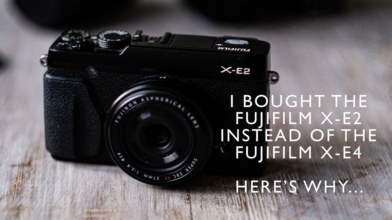
รีวิวอาหารเสริมสำหรับคุณผู้ชาย กินแล้วมันส์มากกก | MUNZ
อย่าลืมติดตามช่อง\”รีวิวของ\”นะครับ:\r
https://bit.ly/2s6kEm1\r
\r
สนใจติดต่อเรื่องการลงโฆษณาหรือการร่วมงาน กรุณาติดต่อผมทางนี้ เท่านั้น\r
For business inquires ONLY contact me here: \r
[email protected]
📲สั่งซื้อMUNZทางออนไลน์พร้อมรับโปรโมชั่นพิเศษได้ที่
👉https://lin.ee/xB7dAEI
👉https://lin.ee/bkNJ2ro
☎️ 0917694693
✅MunzX3
✅สารสกัดจากธรรมชาติ100%
✅ปลอดภัย
✅มีอย.

พลังงานจน Feat. เปาวลี พรพิมล – LABANOON「Official MV」
MV พลังงานจน feat.เปาวลี พรพิมล
LABANOON
New Single 2015
available on iTunes: http://smarturl.it/powerofthepoor
genie records , Mango
http://www.FB.com/Labanoon | http://www.genierecords.com
Instagram @Labanoonband
LABANOON
เมธี อรุณ กีตาร์,ร้องนำ @metee_arun
อนันต์ สะมัน เบส @ananlabanoon
ณัฐนนท์ ทองอ่อน กลอง @maylabanoon
ทำนอง : เมธี อรุณ
เนื้อร้อง : โป โปษยะนุกูล
เรียบเรียง : ลาบานูน
สายลมจางๆ ยังล่องลอยจากแดนไกล กระซิบคอยบอกเบาๆ เตือนให้เราลืมตา…
ชีวิตจนๆอย่างเรา จะเอาอะไรหนักหนา
เช้าลุกขึ้นมาส่งยิ้มให้โชคชะตา ศรัทธายังมีเหลือพอ
ถึงไม่ค่อยมีปัจจัย แต่ใจยังไม่อับจน
หลายครั้งทางชัน แต่ฉันรู้ว่าความจน มันมีพลังดิ้นรน
ก็ไม่เป็นไรเมื่อเกิดมาอย่างนี้ เมื่อมีเท่าที่มีก็ทำมันให้ดี เท่าที่หนทางยังมีอยู่
สู้เพื่อคนที่รัก พิสูจน์ให้ได้ดู ถึงหนักหนาเท่าไรยังไงหัวใจยังมีแรง
ความจนมันเป็นอย่างไร ไม่จนคงไม่เข้าใจ
สองเท้าเปื้อนดิน ชีวิตไม่ง่ายเท่าไร ยังมีคนรอพึ่งพา มากมาย
(สายลมจางๆยังล่องลอยจากแดนไกล กระชิบคอยบอกเบาๆ เตือนให้เราลืมตา
เสียงใจดวงเดิม มันรำพันว่ายังไหว กระชิบคอยปลอบเบาๆ พอให้เราเดินไป
ฝนเพิ่งซากลิ่นไอดิน ทิวไม้โอนเอนไกว ทุกข์หรือสุข สุดแต่ใจ)
ก็ไม่เป็นไรเมื่อเกิดมาอย่างนี้ เมื่อมีเท่าที่มีก็ทำมันให้ดี แลกมันด้วยเหงื่อสู้เพื่อคนที่รัก
พิสูจน์ให้ได้ดู ถึงหนักหนาเท่าไร ยังไงหัวใจยังดีอยู่
เมื่อเลือกได้แค่นี้เมื่อมีเท่าที่มี ก็ทำมันให้ดี ทุ่มเททุกอย่าง สู้เพื่อคนข้างหลัง
สู้มันทุกหนทาง ถึงเหนื่อยล้าเท่าไร ยังไงหัวใจยังมีแรง
Produced by พงศศรัณย์ พุ่มทิพย์
Lyrics Directors : ขจรเดช พรมรักษา , Mango Team
Recorded at Grand’s Studio
Sound Engineer : วรวรรธน์ วิวรรธน์วณิชย์ , อัครพงศ์ ศรีเกื้อกูล
Assistant Engineer : เสาวณีย์ ป้อมถาวร , พชร รัตนอรุณ , วสวัตติ์ หาญลำยวง
Drum Technician : ประมวล ล้อเจริญ
Mixed by Shane Edwards at Karma Sound studios
Mastered by Ted Jensen at Sterling Sound, NY
Executive Producer : พูนศักดิ์ จตุระบุล , ขจรเดช พรมรักษา
Mango : โป โปษยะนุกูล , สุรชัย พรพิมานแมน , อภิชาติ พรมรักษา , พูนศักดิ์ จตุระบุล , เหนือวงศ์ , ขจรเดช พรมรักษา , วิรชา ดาวฉาย
♪ Download on iTunes : $0.69 Buy http://smarturl.it/powerofthepoor
♪ KKBOX Music : http://kkbox.fm/wc30Dx
♪ Digital download : กด 123 1039685 3

นอกจากการดูบทความนี้แล้ว คุณยังสามารถดูข้อมูลที่เป็นประโยชน์อื่นๆ อีกมากมายที่เราให้ไว้ที่นี่: ดูบทความเพิ่มเติมในหมวดหมู่LEARN TO MAKE A WEBSITE
ขอบคุณที่รับชมกระทู้ครับ x e2 pantip